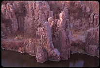
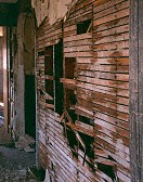
Gate, Cat Canyon

Query = 'ate'
Note that private photos will not be listed below unless you have logged in.
Results from the Directory listing:
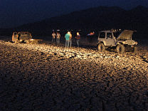
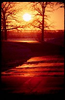
| 2002/Sep04 | Mona Reservoir: On Assignment, the pulling of a single truck out of the mud flats of the drying reservoir, in which seven trucks and about 25 people participate. | |
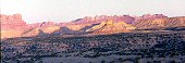
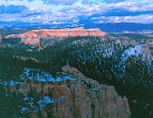
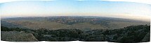
| 2002/Jun19 | Waterpocket Fold, Burr Trail, Bryce Canyon, Alpine Loop Scenic Road | |
| 2002/May11 | Digital shots: Cisco Utah, Goblin Valley State Park, San Rafael Swell, Bryce Canyon National Park, Capitol Reef National Park, Fisher Towers |
Results from the Photographs listing:
|
|
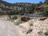
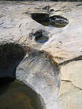
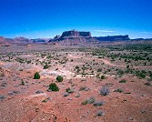
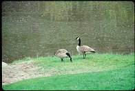
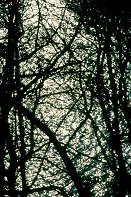
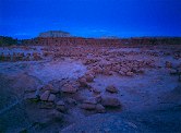
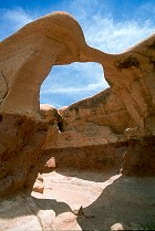
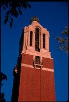
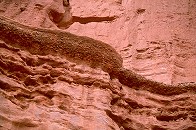
#img_9127
Gate, Cat Canyon |
 |
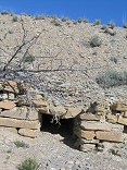
#img_8750
The Hunt ranch, where cows, sheep, and chickens were raised, along with hay and corn for feed, all watered by the Muddy |
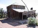 |
#img_8738
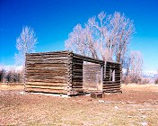
The two-story house (the upper floor was used for storage) built by Charlie Hunt about 1920. The additon came later. |
 |
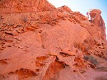
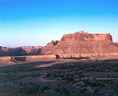
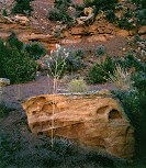
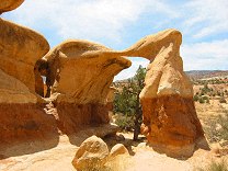
#img_8404
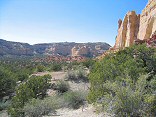
Sandstone erosion (Wingate?) in Ramp canyon |
 |
#img_8390
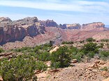
In the distance the Behind the Reef road climbs up the Kayenta shelf. Above is the Navajo, and below is the oddly-sloped Wingate. Below that is the Chinle/Moenkopi valley |
 |
#img_8380
Plateau above the head of Reds Canyon |
 |
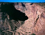
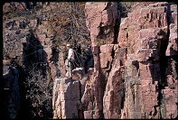
#img_8271
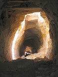
The cavern dug (possibly) by the department of defense as a strategic location, but abandoned. 39deg 09.53N 110deg 43.02W climb down the dugway to get to the horizontal entrance. |
 |
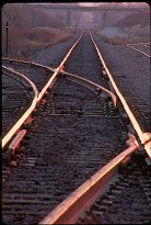
#img_8264
Water culvert, old railroad grade |
 |
#img_8238
Water holes (Wilson Holes) in Lockhart Wash |
 |
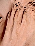
#img_8185
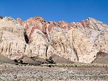
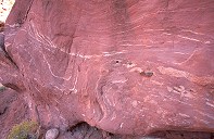
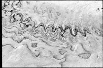
Varigated sandstone patterns. |
 |
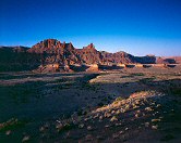
#img_8184
Farther up the Uneva Mine canyon. Wingate sandstone on the walls, and Coconino sandstone making up the bulge of the Swell in the center. |
 |
#img_8183
The Uneva Mine Canyon, second canyon south of I-70. Note the Navajo and Wingate formations, and in back, the Coconino sandstone, same formation that makes the Black Box. |
 |
#img_8180
The Grand Canyon Group on end: Carmel, Navajo, Kayenta, Wingate formations. |
 |
#img_8100
Wingate sandstone Behind the Reef road San Rafael Swell |
 |
#458-2
mexican mt slope just above second gate on mexican mt rd |
 |
#458-3
mexican mt slope just above second gate on mexican mt rd |
 |
#459-4
the reef, west side slope just above second gate on mexican mt rd |
 |
#459-3
mexican mt and the cliffs this location is very good for sun angle! slope just above second gate on mexican mt rd |
 |
#456-2
lone peak, cliffs north of mexican mt slope just above second gate on mexican mt rd |
 |
#450-3
Goodwater canyon, looking North. Time uncertain. Entered when slide developed. Original entry lost? Main sideroad to East side of Goodwater cyn. |
 |
#448-1
mexican mountain, san rafael reef (west side) second gate, mex. mt. rd., on cliff. |
 |
#453-2
pink cliffs, south side of the Paria overlook, Powell Point illuminated Piracy point @ 7th turnout (big) =Farview point |
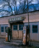 |
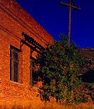
#435-2
Old gas station, with pumps hazy, obstructed clouds State st, Scipio Utah |
 |
#435-1
Old gas station hazy, obstructed clouds Center & State, Scipio Utah |
 |
#430-1
Payson lake Tripod as low as possible, near water. |
 |
#407-2
Water-worn rock, dead, tall weed Long Canyon, Burr Trail |
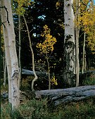 |
#422-4
Aspen against apine microwave area, below gate |
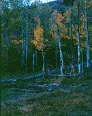 |
#423-1
Aspen, spring, cow watering hole 50 sec lower meadow, nebo loop,Sprigs by Trail Pass |
 |
#131-3199_img
An hour later, still no observable movement. |
 |
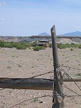
#403-3
decrepid gate and fence, dusk by the sunflowers |
 |
#391-1
"tit+teen+pemale"
Power station <i>insulators max rise, raised bed, 2.5 in rise pol rotated for bluest sky, orange builging</i> Eureka UT |
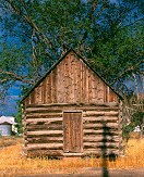 |
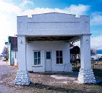
#378-3
Old shack Late afternoon sun Nephi Utah 200 N 200 W wpt115 Nephi Utah |
 |
#126-2646
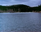
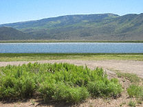
Koosharem Reservoir, the only full body of water I have seen this year in Utah |
 |
#124-2402
Metate Arch Devils Garden Outstanding Nature Area |
 |
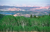
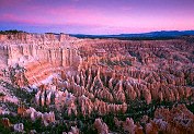
#123-2356
Bristlecone Point, with Powell Point (south end of the Aquarius Plateau) in the background Bryce Point Bryce Canyon National Park Utah |
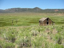 |
#121-2197
An old shack in a well-irrigated field East end of Utah highway 20 |
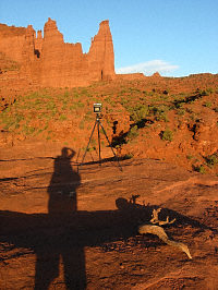 |
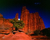
#119-1928_img
Again, my shooting setup, later in the afternoon than the previous shot Fisher Towers BLM area |
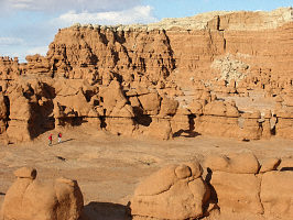 |
#118-1808_img
Two photographers, late afternoon Goblin Valley State Park |
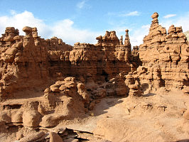 |
#117-1797_img
Behind the big green dome Goblin Valley State Park |
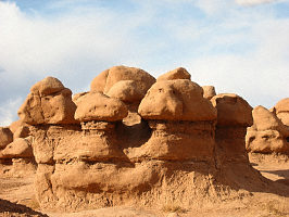 |
#117-1793_img
Goblin Valley State Park |
 |
#117-1790_img
Goblin Valley State Park |
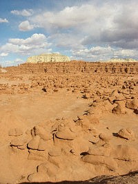 |
#117-1786_img
Hoodoos and goblins Goblin Valley State Park Utah |
 |
#113-1357_img
Cupboard, late afternoon. |
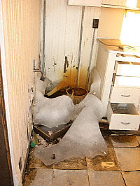 |
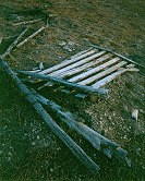
#113-1350_img
The problem with water dripping in an unmaintained building all winter. |
 |
#1204
Palisades State Park (PSP), SD |
 |
#247-35
Sunset over the melting snow Oakwood Lakes State Park Bruce SD |
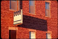 |
#252-23
Sign, late day, Madison SD |
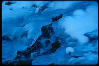 |
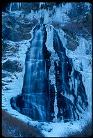
#241-35
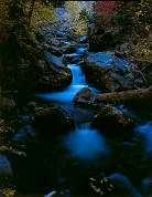
Snow and ice over a tributary of the Provo River, Provo Canyon, Utah. |
 |
#1193
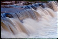
Falls near Baltic, SD |
 |
#1272
Slow shutter speed. |
 |
#1267
|
 |
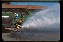
#n051-10
These are photographs taken at an SCA event, Armorgeddon, 14-17 Sept 2000, at Union County State Park south of Sioux Falls SD. |
 |
#1244
Trees growing in the rock at Palisades State Park, SD |
 |
#1318
The semi-annual flushing of the water hydrant system, Brookings SD |
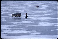 |
#246-07
Ice fishing, Lake Herman State Park, Madison SD |
 |
#241-30
Bridal Veil Falls Provo Canyon Provo UT |
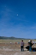 |
#a007-06
The debris left in the sky afterthe dust devil dissipated, UROC launch, Utah |
 |
#218-10
Tracks illuminated by the dawn, DM&E crossing 22nd Ave., Brookings SD. Brookings SD |
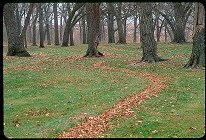 |
#221-19
Leaf-sweeper art, Oakwood Lake State Park, Bruce SD. |
 |
#222-20
Herman Lake State Park, late-season, near Madison SD. |
 |
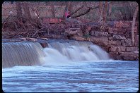
#225-02
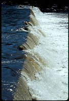
Stair step Falls, Split Rock Creek dam, Garretson SD. |
 |
#225-36
Palisades, Palisades State Park, near Garretson SD. |
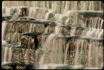 |
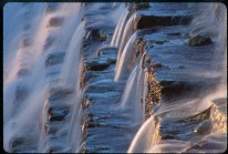
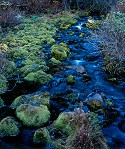
#227-09
Falls and Moss, Split Rock Creek dam, Garretson SD. |
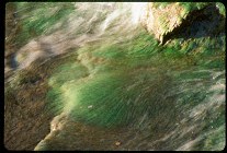 |
#227-15
Green Moss, White Water, Split Rock Creek dam, Garretson SD |
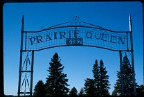 |
#208-02
The Prairie Queen Cemetery, names after an old church of the same name, now defunct. A few miles south of Volga SD |
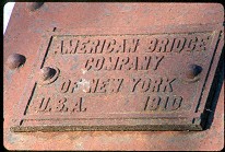 |
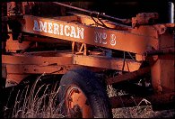
#209-21
American Bridge Company of New York, U.S.A., 1910 DM&E bridge, East of Volga SD |
 |
#212-32
Fishing dock Lake Madison State Park Madison SD |
 |
#214-03
|
 |
#251-16
Boiler plate, old crane, Dell Rapids SD |
 |
#a101-06
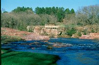
High water, Palisades SP. |
 |
#296-05
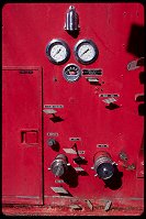
Water Control Panel, Bushnell SD |
 |
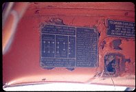
#294-30
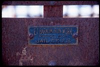
Maker's ID plate, old city jail cell, Bushnell city park, SD |
 |
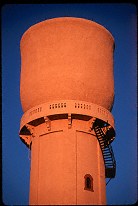
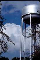
#1054
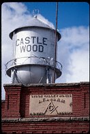
Water tower, masonic lodge Castlewood SD |
 |
#239-25
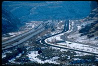
Echo Canyon I80 Utah |
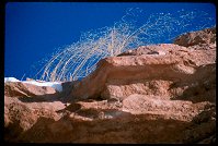 |
#239-16
Clifftop weeds, Interstate 80 East of Cheyenne WY. |
 |
#1071
Photos of a guy named Travis practicing a traverse in Palisades State Park. |
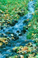 |
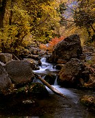
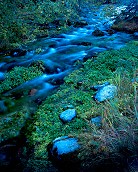
#2256
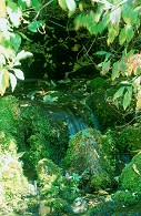
Small stream (originating form a spring) Maple Bench campground Payson Canyon UT |
 |
#1236
Travis Palisades State park Garretson SD |
 |
#070-36
Highwater |
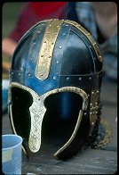 |
#2115
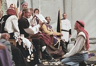
The Coppergate helmet that won the Arts & Science competition, crafted by Jurgen of Northshield. |
 |
#1444
A caterpillar nest |
 |
#202-27
The "Cup" water tower (telephone lines removed digitally) North side of town Pipestone MN |
 |
#1395
|
 |
#a104-12
Oakwood Lakes State Park Bruce SD |
 |
#a101-13
Normally there is a 6-8 foot waterfall here. That night the basin was filled. |
 |
#a101-25
and normal, two days later. |
 |
#a101-30
The Sun's reflection off floodwaters, shot through spring-bare brances |
 |
#2206
Shots around Palisades State Park |
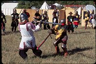 |
#2087
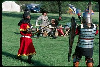
Bear-pit fighting in the privately sponsored Great Sword Tournament. |
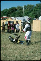 |
#2099
See that fighter on the ground? He defeated Jarl Thjothrekr, who had this significant advantage. |
 |
#n052-17
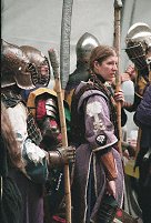
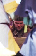
In the Hall, following opening ceremonies, preparing for the Woods battle. In the background - Graf Volkmar Katzbalger giving water to someone that looks like Sir Roger. In the foreground, Lady Corasander nic Murtrie (with her helm off), Lord Aubrey d'Aubusson and (maybe) HE Logan. |
 |
#n055-10
Though I don't know why, Fernando seemed to enjoy the gift of PlayDoh, almost as much as the Calontir gentle who ate some. |
 |
#1471
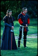
Photos taken at the Lusty Day in May activity, sponsored by the Shire of Western Keep, in the Principality of Northshield of the Middle Kingdom, the Brookings SCA organization. See the Exhibit for the best-of photos. See also 25May00. Lord and Lady Heir of Northshield, Sir Tristan von Eisig and Lady Eilika von Lutzen Oakwood Lake State park Bruce SD |
 |
#1499
This sort of fighting is known as Bear Pit, where the winning fighter holds the field until he or she is defeated. |
 |
#a072-12
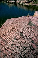
"Rocks and Waves"
This is Sioux Quartzite. It was layed down 2 million years ago on the bottom of a shallow lake. Due to silting, the wave pattern formed during mild times were preserved throughout the yearly floods. This patterned sand was compressed into the rock you see Palisades State Park Near Garretson SD |
 |
#300-4
Delapidated walls, old house Junction, US-89 & US-6 Utah |
 |
#2281
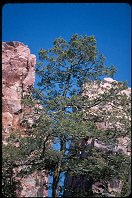
Pine on a table Cascade Springs drive UT |
 |
#233-1
This is the schoolhouse my grampa attended in his youth. It's located on the South Park Loop. It was subsequently used by my Uncle Nate as a workshop. The roof and floor are now gone, and only cows enjoy this view of it. South park Jackson WY |
 |
#239-1
Cascades on the Santaquine River Santaquine Canyon Above Santaquin Utah |
 |
#240-3
Small cascade on Santaquine River Santaquine Canyon Utah |
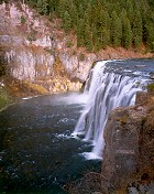 |
#244-4
Upper Mesa Falls Mesa Falls Idaho |
 |
#245-2
Small creek with moss Alpine loop (top of American Fork Canyon) Utah |
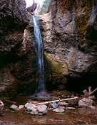 |
#249-1
The Grotto Payson Canyon (Mt. Nebo Loop) Utah |
 |
#250-3
Water basin, The Grotto falls Payson Canyon (Mt. Nebo Loop) Utah |
 |
#270-36
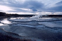
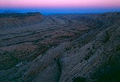
Great Fountain geyser (not erupting) |
 |
#272-4
Mount Nebo |
 |
#2319
Striated sandstone formations |
 |
#286-1
Underexposed, and very saturated shot of Cottontop. |
 |
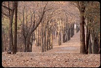
#2396
Towers, juniper tree, late-day sun |
 |
#311-1
Little Wild Horse slot canyon Near Goblin Valley State park, San Rafeal Swell Utah |
 |
#311-2
Little Wild Horse slot canyon Near Goblin Valley State park, San Rafeal Swell Utah |
 |
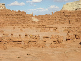
#324-1
Goblin Valley Twilight Goblin Valley State Park |
 |
#336-4
Petrified Wood Escalante State Park |
 |
#349-12
In the distance, Powell Point, at the southern end of the Aquarius Plateau |
 |
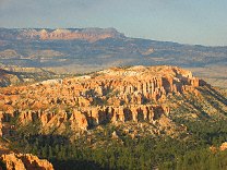
#349-19
Late afternoon Bryce Canyon National Park |
 |
#353-04
Metate Arch Devil's Garden Outstanding Nature Area |
 |
#356-09
Waterpocket Fold, Impossible Peak (?), in the background is Wildcat mesa |
 |
#357-2
The Waterpocket Fold, Grand Gulch, from the Strike Valley Overlook |
 |
#b039-11
School: Egan Consolidated District No. 1 Egan SD |
 |
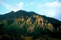
#sanrafaelnorth
Note the (slightly exagerated) bulge of the Swell |
 |
#285-4
Odd exposure, too saturated |
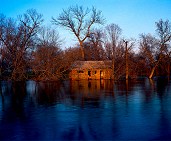 |
#flood
Flooded old homestead on the Big Sioux River Egan SD |
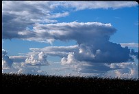 |
#059-30
Anvil thunderhead MN stateline, near Aurora SD |
 |
#n057-14
Tradition specifies that only those who are proficient in all weapons systems may be made Huscarls. Generally, the fighter must demonstrate a great degree of skill at arms, be honorable on and off the field, and be active in promoting fighting through marshalling, teaching, et cetera. |
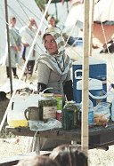 |
#n057-24
Countess Aislinn, water bearing during the field battle. |
 |
#a105-12
New spring growth Palisdaes State Park SD |
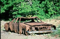 |
#v115-28
An old car (and target) located at an old ore facility NW Eureka UT |
 |
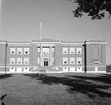
#083-04
Bell Tower, South Dakota State University Campus |
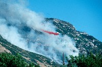 |
#164m-05
Forest Service plane dropping retardant on the Slate Canyon fire, August 2001. |
 |
#172v-02
Mt. Timpanogus, late day. |
 |
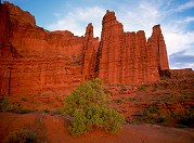
#2324
Wide-angle view of the towers from the far end of the 2.2 mile trail. Titan is in the center of the frame. Bring plenty of water, you'll want to spend some time out there. Fisher Towers BLM area Moab UT |
 |
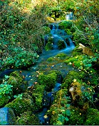
#184-1
The upper cascade of Cascade Springs, just off the Alpine Loop. |
 |
#045-28
Water, free and enslaved. City park Brookings SD |
 |
#210-4
Small rivulet in American Fork Canyon |
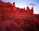
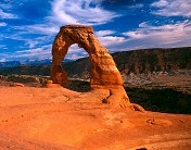 |
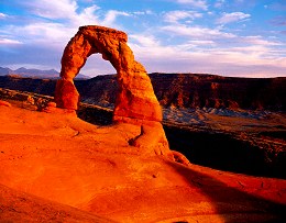
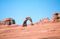
#delicate
Delicate Arch, sunset Arches National Park |
 |
#203-2
The lower cascade, Cascade Springs |
 |
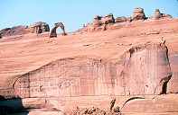
#226-1
Weathered rock, striated clouds Arches National Park Moab Utah |
 |
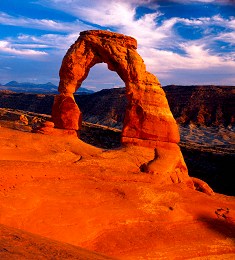
#225-1
Delicate Arch, sunset Arches National Park Moab Utah |
 |
#226-4
Delicate Arch, sunset Arches National Park Moab Utah |
 |
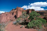
#2250
Delicate Arch from the viewpoint near the road. |
 |
#b083-01
"Grass and Ice"
A single stand of grass survives the prairie winter winds. The dark bands in the snow come from alternate deposits of snow and dust blown from the surrounding fields, then scoured down by the dry winds of winter South of town Elkton SD |
 |
#2274
Small stream & falls American Fork Canyon UT |
 |
#2251
Delicate Arch, dimunitized by the massive sandstone wall below it. Arches N.P. |
 |
#2406
Layer of conglomerate in the sandstone Fisher Towers |
 |
#203-3
A portion of the upper cascade, Cascade Springs |
Results from the Comments:
 |
Bruce Wilson
of Provo, UT
thought on 7/17/2007 that this photo was displayed properly
and added the following: |
 |
An anonymous visitor
of Kingston
thought on 1/9/2005 that this photo was superb
and added the following: |
 |
Your Uncle George
of Miami
thought on 12/27/2004 that this photo was superb
and added the following: |
|
|
Rivi
of Dubai - U.A.E.
thought on 10/19/2004 that this photo was superb
and added the following: |
|
|
Terri M.
of Idaho Falls, ID
thought on 7/27/2004 that this photo was superb
and added the following: |
 |
Lauren Anderson
of Ogden, UT
thought on 5/22/2003 that this photo was 'interesting'
and added the following: |
 |
Bruce Wilson
thought on 8/29/2002 that this photo was displayed properly
and added the following: |
Private photo not shown. |
Please login on the Catalog page to view comments on private photos. |
 |
Bruce Wilson
thought on 4/11/2001 that this photo was displayed properly
and added the following: |
 |
Bruce Wilson
thought on 4/7/2001 that this photo was okay
and added the following: |
 |
Bruce Wilson
of Brookings SD
thought on 4/5/2001 that this photo was good
and added the following: |
 |
Bruce Wilson
thought on 4/5/2001 that this photo was good
and added the following: |
Results from the old catalog:
This search is a simple search for a word that appears somewhere in the database.
It is best to search a single word only. Multiple words are treated as OR.
If you find photos in the photographs section, you might want to look at
all the photographs in that photos directory to find similar matches.
Click here to list all keywords in the
database.
Click here to list the most popular photos in the
database.