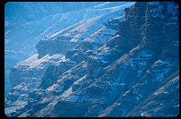
Moore Road: gypsum mine, Red Ledges, Coal Cliffs (Molen Reef), cliffs of the Wasatch Pleatau above Ferron

Query = 'cliff'
Note that private photos will not be listed below unless you have logged in.
Results from the Directory listing:
| 2002/Nov03 | Long Canyon, Circle Cliffs, Capitol Reef, along the Burr Trail (LF) |
Results from the Photographs listing:
|
|
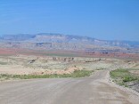
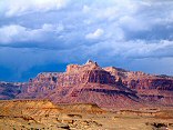
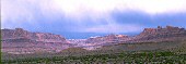
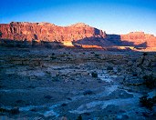
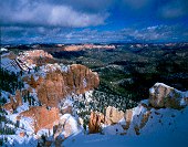
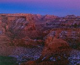
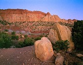
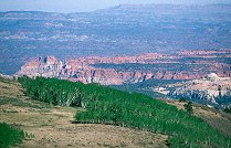
#img_9250
Moore Road: gypsum mine, Red Ledges, Coal Cliffs (Molen Reef), cliffs of the Wasatch Pleatau above Ferron |
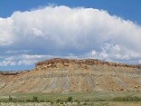 |
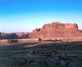
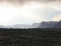
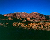
#img_9238
Coal Cliffs |
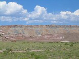 |
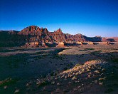
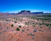
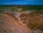
#img_9234
Foreground Morrison formation painted hills, behind them the Coal Cliffs of the Molen Reef |
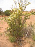 |
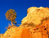
#img_8885
Cliffrose? |
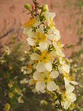 |
#img_8884
Cliffrose? |
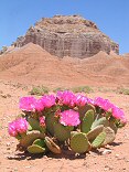 |
#img_8698
Beavertail Opuntia basilaris The Summerville cliffs between Middle Wild Horse Mesa and Big Wild Horse Mesa |
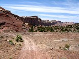 |
#img_8389
Behind the Reef Road. This road goes all the way along the visible cliffs |
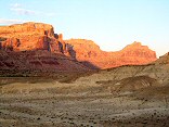 |
#img_8216
Cliffs above Mexican Mountain Road Near the Bridge campground |
 |
#img_7972
Cliffs above Mexican Mountain Road Lockhart Box San Rafael Swell |
 |
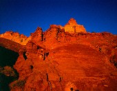
#459-3
mexican mt and the cliffs this location is very good for sun angle! slope just above second gate on mexican mt rd |
 |
#456-2
lone peak, cliffs north of mexican mt slope just above second gate on mexican mt rd |
 |
#464-4
Cliffs along mexican mountain rd fule rise West Jackass benches south of mex mt (above Swasey's leap turnoff) |
 |
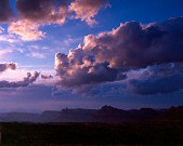
#459-2
clearing storm, san rafael river exit canyon deep, rolling thunder from Book cliffs. I70 audible. South Jackass benches south of mex mt |
 |
#img_4677
The cliffs east of Mexican Mountain Road Jackass Benches |
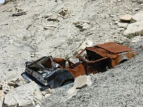 |
#img_4639
Decrepid cars tossed off the cliffs Castle Dale to Buckhorn Well road |
 |
#450-1
cliffs, north of mx mt mex mt foot trail |
 |
#449-1
cliffs, north of mx mt mex mt foot trail |
 |
#448-4
cliffs, north of mx mt mex mt foot trail |
 |
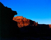
#448-1
mexican mountain, san rafael reef (west side) second gate, mex. mt. rd., on cliff. |
 |
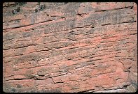
#439-4
pink cliffs detail Losee canyon, Arches trail loop, near the wooden stairs |
 |
#453-2
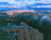
pink cliffs, south side of the Paria overlook, Powell Point illuminated Piracy point @ 7th turnout (big) =Farview point |
 |
#437-1
pink cliffs, south side of the Paria overlook Piracy point @ 7th turnout (big) =Farview point |
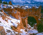 |
#438-4
bridge, clifftops 6th turnout = natural bridge |
 |
#436-4
pink cliffs, near and far 1st turnout going north |
 |
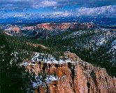
#436-2
the eastern wall of the pink cliffs storm blowing in from south Rainbow point |
 |
#444-3
Cliffs, San Rafael river valley near san rafael bridge |
 |
#445-2
Cliffs, San Rafael river valley near san rafael bridge |
 |
#444-2
Cliffs, San Rafael river higher vantage near san rafael bridge |
 |
#445-1
Cliffs, San Rafael river higher vantage near san rafael bridge |
 |
#444-4
Cliffs, San Rafael river near san rafael bridge |
 |
#443-2
Little Grand Canyon cliffs at 5, before sunrise xp 5 sec. goofed, forgot filter factor Wedge overlook, west side |
 |
#442-2
Little Grand Canyon cliffs at 5, after sunset xp 5 sec. Wedge overlook, east side |
 |
#441-4
Little Grand Canyon cliffs at 5.5, just after sunset 1.5 sec. Wedge overlook, east side |
 |
#441-1
Little Grand Canyon cliffs at 5.5 Wedge overlook, east side |
 |
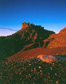
#408-3
Circle cliffs Tilted down a bit. End of Long Canyon, Burr trail, on boulder |
 |
#411-1
Circle cliffs w/boulders full sun, too much contrast End of Long Canyon, Burr trail, on boulder |
 |
#406-4
Circle cliffs w/boulders Shot 5 sec. End of Long Canyon, Burr trail, on boulder |
 |
#406-3
Circle cliffs w/boulders 20 sec metered, shot 26 sec. End of Long Canyon, Burr trail, on boulder |
 |
#406-1
white cliffs Southern Tarantula mesa, from border of Capitol reef and GS-E |
 |
#409-4
Circle cliffs, painted desert. A workshop is nearby. Dykinga? Burr trail |
 |
#405-1
Circle cliffs, painted desert. A workshop is nearby. Dykinga? Burr trail |
 |
#405-2
Circle cliffs, painted desert. A workshop is nearby. Dykinga? Burr trail |
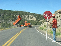 |
#127-2792
Moving dirt from the cliff just around the corner (eroded down to the roadbed) to butress stream erosion here. |
 |
#239-33
Cliffs above the mouth of Echo Canyon, Utah |
 |
#357-1
Long Canyon overlook, North end of Long Canyon, toward the Circle Cliffs and Capitol Reef |
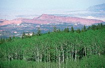 |
#356-08
Circle cliffs (Big Bown bench) |
 |
#356-03
The northern end of the Circle cliffs |
 |
#355-08
Long Canyon overlook, North end of Long Canyon, toward the Circle Cliffs and the Henry Mountains |
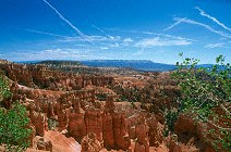 |
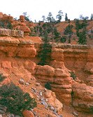
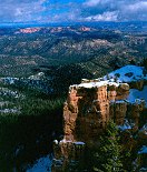
#350-28
Contrails over the pink cliffs Bryce Canyon National Park |
 |
#239-32
Echo Canyon, Utah |
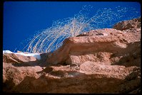 |
#239-16
Clifftop weeds, Interstate 80 East of Cheyenne WY. |
Results from the Comments:
No matches.Results from the old catalog:
This search is a simple search for a word that appears somewhere in the database.
It is best to search a single word only. Multiple words are treated as OR.
If you find photos in the photographs section, you might want to look at
all the photographs in that photos directory to find similar matches.
Click here to list all keywords in the
database.
Click here to list the most popular photos in the
database.