The Muddy Creek, southeast of the Wild Horse Creek wash

Query = 'east'
Note that private photos will not be listed below unless you have logged in.
Results from the Directory listing:
| 05Jul00 | Climbers at Ophir UT, balloon launch at Provo UT, Hang gliders above Provo UT, shots around eastern SD. | old |
| 21Jun00 | Shots around eastern SD, Hang gliders above Provo UT. | old |
Results from the Photographs listing:
|
|
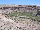
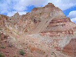
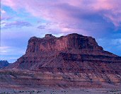
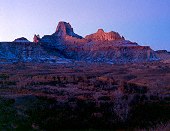
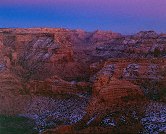
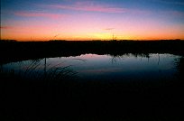
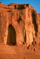
#img_8649
The Muddy Creek, southeast of the Wild Horse Creek wash |
 |
#img_8607
A jeep trail in the foreground, and a single-track dropping into the canyon east of Flat Top. |
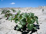 |
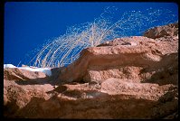
#img_8307
Phacelia East of the Reef |
 |
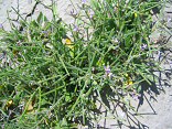
#img_8306
Yellow beeplant Cleome lutea East of the Reef |
 |
#img_8305
Must-mustard Chorispora tenella East of the Reef |
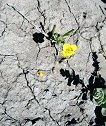 |
#img_8304
Camissonia (in the evening primrose family) East of the Reef |
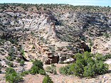 |
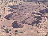
#img_8267
Upper reach of one of the upper eastern canyons of Buckhorn Wash |
 |
#img_8265
Upper reach of one of the upper eastern canyons of Buckhorn Wash |
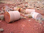 |
#img_8073
Three-foot core samples, flats east of Temple Mountian Calyx Bench, Temple Mountian San Rafael Swell |
 |
#img_8071
Temple Moutain, East side Temple Mountian San Rafael Swell |
 |
#img_7685
The east side of the Reef |
 |
#img_4794
Morning view of the San rafael River valley East side of the Wedge |
 |
#img_4677
The cliffs east of Mexican Mountain Road Jackass Benches |
 |
#462-3
mexican mt above Swazy's Leap, looking east |
 |
#450-3
Goodwater canyon, looking North. Time uncertain. Entered when slide developed. Original entry lost? Main sideroad to East side of Goodwater cyn. |
 |
#454-3
Looking east,, sun and god beams inspiration -t |
 |
#436-2
the eastern wall of the pink cliffs storm blowing in from south Rainbow point |
 |
#446-4
Peaks behind (southeast) of windowblind metered 60 sec, shot 90 window blind peak? mexican mt rd |
 |
#445-3
Assembly Hall Peak, East wall of Buckhorn Wash difficult to focus, 97% waning moon, Expose predicts 2 hrs exposure, my calc = 40 min. 39°404.605N 110°40.787W 5135f, wpt038 0.5 mile down corral rd, near San Rafael Bridge |
 |
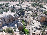
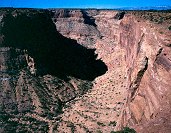
#442-4
Little Grand Canyon canyon haze = 5 Wedge overlook, east side |
 |
#442-2
Little Grand Canyon cliffs at 5, after sunset xp 5 sec. Wedge overlook, east side |
 |
#441-4
Little Grand Canyon cliffs at 5.5, just after sunset 1.5 sec. Wedge overlook, east side |
 |
#441-1
Little Grand Canyon cliffs at 5.5 Wedge overlook, east side |
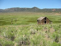 |
#121-2197
An old shack in a well-irrigated field East end of Utah highway 20 |
 |
#105-03
The left-turn bliner from an old worktruck East of town, by the D&I railyard Del Rapids SD |
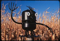 |
#097-20
One of several rather amusing figures made of scrap iron on Hwy 14, 5 miles East of Brookings, SD |
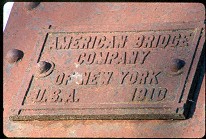 |
#209-21
American Bridge Company of New York, U.S.A., 1910 DM&E bridge, East of Volga SD |
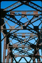 |
#209-18
Bridge girders DM&E line, East of Volga SD |
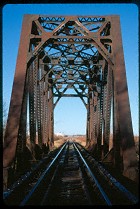 |
#209-10
Bridge, DM&E line East of Volga SD |
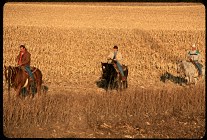 |
#228-03
Riding home, Eastern SD |
 |
#220-06
Bridge, engine DM&E bridge, East of Volga SD |
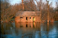 |
#a101-34
In the Spring of 2001 the Big Sioux river in Eastern South Dakota flodded. This is taken after the river started coming down, about a week after the rains stopped East side of town Egan South Dakota |
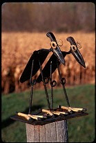 |
#097-23
One of several rather amusing figures made of scrap iron on Hwy 14 East of Brookings, SD |
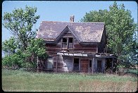 |
#1661
Old house East of Huron SD |
 |
#a074-28
"Calm night, the Prairie"
A typical summer night on the prairie, with a typical South Dakota sunset. East of town, looking towards Brookings SD |
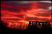 |
#217-02
DM&E bridge, sunset East of Volga SD |
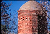 |
#201-16
Detail, drying silo US-14, East of Brookings SD |
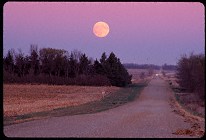 |
#203-20
Country road, moonrise. East of Pipestone MN |
 |
#062-08
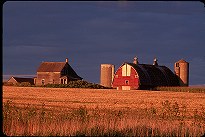
The sun sets on another South Dakota farm US14 East of Brookings South Dakota |
 |
#v116-10
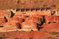
Iron ore processing plant, with gravity-fed tanks East of Goshen Utah |
 |
#v129-12
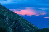
Pink alpenglow on clouds, mountains. East of Spanish Fork UT |
 |
#2382
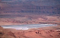
Salt drying pans East of Dead Horse Point UT |
 |
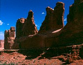
#2375
Detail, the wall East of Park Ave. Arches |
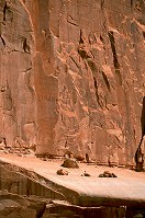 |
#2228
Detail East side of Park Avenue. Arches N.P. |
 |
#2329
To the East of the trail end, inaccesible by formal trail Fisher Towers |
 |
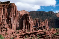
#314-1
East side of Park Avenue, morning Arches National Park |
 |
#239-16
Clifftop weeds, Interstate 80 East of Cheyenne WY. |
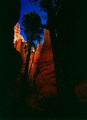 |
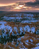
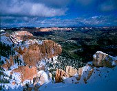
#372-3
Douglas fir, East end of Wall Street |
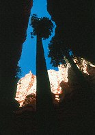 |
#350-07
Old Douglas fir tree at the Eastern end of Wall Street Bryce Canyon National Park, Navajo Loop |
Results from the Comments:
 |
Bruce Wilson
thought on 4/5/2001 that this photo was okay
and added the following: |
Results from the old catalog:
This search is a simple search for a word that appears somewhere in the database.
It is best to search a single word only. Multiple words are treated as OR.
If you find photos in the photographs section, you might want to look at
all the photographs in that photos directory to find similar matches.
Click here to list all keywords in the
database.
Click here to list the most popular photos in the
database.