Behind the Reef road descends in to Ramp canyon

Query = 'end'
Note that private photos will not be listed below unless you have logged in.
Results from the Directory listing:
| 2005/July20 | A few shots at Panorama Point (Glen Canyon), and at the rock crawling area, south end of Lake Mountain. | |
| 17Mar00 | Scenics around SD, Henderson MN, wind turbines near Lake Benton MN. | old |
Results from the Photographs listing:
|
|
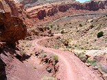
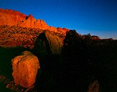
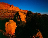
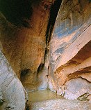
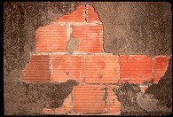
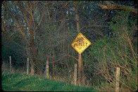
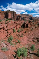
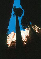
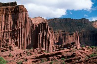
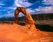
#img_8401
Behind the Reef road descends in to Ramp canyon |
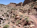 |
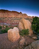
#img_8392
The Behind the Reef Road descends a slope of loose boulders |
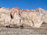 |
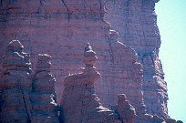
#img_8180
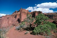
The Grand Canyon Group on end: Carmel, Navajo, Kayenta, Wingate formations. |
 |
#img_8036
North end of the North Fork of Coal Wash Just below the Devil's Racetrack San Rafael Swell |
 |
#img_8033
Green Vein Mesa mine? North end of Reds Canyon San Rafael Swell |
 |
#img_8032
Green Vein Mesa mine? North end of Reds Canyon San Rafael Swell |
 |
#img_8031
Green Vein Mesa mine? North end of Reds Canyon San Rafael Swell |
 |
#img_8030
Unnamed pinnacle north of Family Butte North end of Reds Canyon San Rafael Swell |
 |
#470-3
Sage, hillside, Spanish Fork peak, midground maple=orange far end of Wadsworth Peak trail Right Fork of Hobble Creek Canyon |
 |
#img_5067
End of the trail, White Horse Canyon, below the road |
 |
#img_5005
Bench above the end of the Swazy's Leap trailhead |
 |
#408-3
Circle cliffs Tilted down a bit. End of Long Canyon, Burr trail, on boulder |
 |
#411-1
Circle cliffs w/boulders full sun, too much contrast End of Long Canyon, Burr trail, on boulder |
 |
#406-4
Circle cliffs w/boulders Shot 5 sec. End of Long Canyon, Burr trail, on boulder |
 |
#406-3
Circle cliffs w/boulders 20 sec metered, shot 26 sec. End of Long Canyon, Burr trail, on boulder |
 |
#406-2
Organ, teeth, 35.5 f/stops Capitol reef? south end, by Muley twist |
 |
#407-4
Dry narrows (CNYN), pool at end Metered at 20 sec, shot 45 sec. Canyon faces SE Long Canyon, Burr Trail |
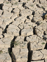 |
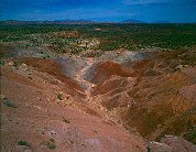
#131-3160_img
The offending mud flats: two inches of dried clay, eight inches of soft and slippery mud. |
 |
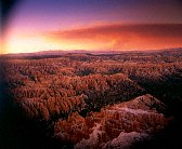
#127-2702
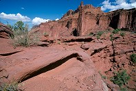
The Southern end of the grand gulch. These are the edges of upturned layers of rock, the upper layers have eroded long ago, leaving only a small ridge. I'm standing at the Strike Valley overlook, perched atop a 45 degree layer of Navajo sandstone. |
 |
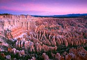
#123-2356
Bristlecone Point, with Powell Point (south end of the Aquarius Plateau) in the background Bryce Point Bryce Canyon National Park Utah |
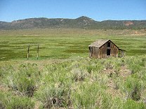 |
#121-2197
An old shack in a well-irrigated field East end of Utah highway 20 |
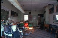 |
#106-11
Hendricks MN barbershop (closed, shot through front window). |
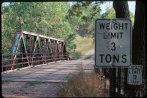 |
#051-32
Bridge, South end of 22nd ave. Brookings SD |
 |
#051-23
Bridge, South end of 22nd ave. Brookings SD |
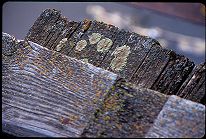 |
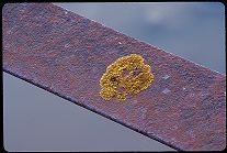
#051-22
Dry plank, lichen Bridge, South end of 22nd ave. Brookings SD |
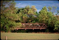 |
#051-08
Bridge, once a major road out of town South End of 22nd Avenue Brookings SD |
 |
#045-08
The ones on the end go first. |
 |
#291-21
Detail, suspended merry-go-round playground equipment City park Bushnell SD |
 |
#265-27
Various shots in and around Hendricks MN |
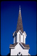 |
#264-27
Church steeple Hendricks MN |
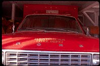 |
#106-05
Hendricks MN fire ambulance. |
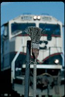 |
#1280
"So much depends upon the broom, dusted with rust, besides the old traintrack." |
 |
#1297
South end of 22nd ave Brookings SD |
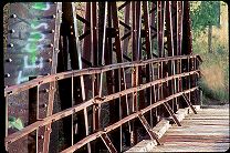 |
#051-25
My favorite bridge Bridge, South end of 22nd ave. Brookings SD |
 |
#1524
North end of 22nd ave Brookings SD |
 |
#052-31
South end of 22nd ave. Brookings SD |
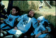 |
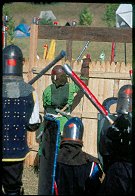
#2189
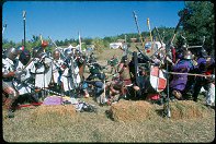
Modred Blackhorse, Gareth the Black and Rodney of Wendigo of Company Nevermore, finding shade by the haybales. |
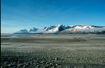 |
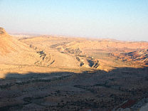
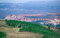
#270-22
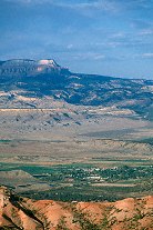
The vast mud pan left by the diminishing Lake Jackson, Teton range in the background. Teton N.P., North end WY |
 |
#1026
"Still Life with Front-end Loader"
Quarry North of Estelline SD |
 |
#n051-28
The marshal's tour of the woods battlefield. Vladimir Zinonovich (mka David Henderson), who is from Vatavia. |
 |
#2327
Trail-end cirque Fisher Towers BLM area Moab UT |
 |
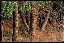
#372-3
Douglas fir, East end of Wall Street |
 |
#357-1
Long Canyon overlook, North end of Long Canyon, toward the Circle Cliffs and Capitol Reef |
 |
#356-03
The northern end of the Circle cliffs |
 |
#355-08
Long Canyon overlook, North end of Long Canyon, toward the Circle Cliffs and the Henry Mountains |
 |
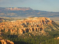
#350-07
Old Douglas fir tree at the Eastern end of Wall Street Bryce Canyon National Park, Navajo Loop |
 |
#349-12
In the distance, Powell Point, at the southern end of the Aquarius Plateau |
 |
#337-26
Ascending the Corkscrew (ancient art line) |
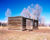 |
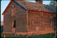
#233-1
This is the schoolhouse my grampa attended in his youth. It's located on the South Park Loop. It was subsequently used by my Uncle Nate as a workshop. The roof and floor are now gone, and only cows enjoy this view of it. South park Jackson WY |
 |
#1928
Palisades S.P. |
 |
#2165
Company Nevermore on the left side of the frame, deploying from reserve to engage the south end of the bridge. |
 |
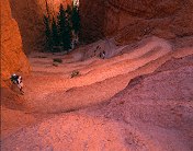
#2325
Rock formations, Titan, part of the cirque at the trail end |
 |
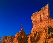
#2324
Wide-angle view of the towers from the far end of the 2.2 mile trail. Titan is in the center of the frame. Bring plenty of water, you'll want to spend some time out there. Fisher Towers BLM area Moab UT |
 |
#2329
To the East of the trail end, inaccesible by formal trail Fisher Towers |
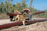 |
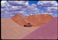
#2283
Workers on a gas pipeline crew bending a 2' diameter pipe. |
 |
#201v-14
Bend (do not ignore) |
 |
#160p-17
|
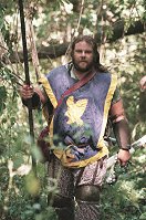
 |
#2194
Northshield, defending the fort. Sir Lars? |
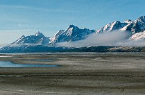 |
#270-20
Part of the vast mud pan left by the diminishing Lake Jackson, Teton range in the background. Teton N.P., North end WY |
Results from the Comments:
 |
Maxim
of Ohio
thought on 10/30/2005 that this photo was good
and added the following: |
 |
Bruce Wilson
of Provo, Utah
thought on 1/9/2005 that this photo was displayed properly
and added the following: |
 |
Your Uncle George
of Miami
thought on 12/27/2004 that this photo was superb
and added the following: |
 |
Bruce Wilson
of Provo, Utah
thought on 10/20/2004 that this photo was displayed properly
and added the following: |
 |
Bruce Wilson
of Provo, Utah
thought on 2/23/2004 that this photo was displayed properly
and added the following: |
 |
Cemal Ekin
of Rhode Island
thought on 11/24/2002 that this photo was superb
and added the following: |
 |
daniel mendez
of Ann Arbor, MI
thought on 6/27/2002 that this photo was good
and added the following: |
 |
jack gilbert
of Toronto
thought on 3/13/2002 that this photo was superb
and added the following: |
|
|
Bruce Wilson
of Brookings SD
thought on 4/5/2001 that this photo was superb
and added the following: |
Results from the old catalog:
This search is a simple search for a word that appears somewhere in the database.
It is best to search a single word only. Multiple words are treated as OR.
If you find photos in the photographs section, you might want to look at
all the photographs in that photos directory to find similar matches.
Click here to list all keywords in the
database.
Click here to list the most popular photos in the
database.