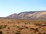
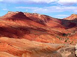
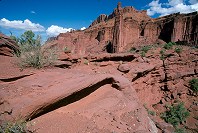
Morrison Formation south of Moore Road

Query = 'form'
Note that private photos will not be listed below unless you have logged in.
Results from the Directory listing:
| 2004/Nov08 | Large Format: Skyline Drive, San Rafael Swell | |
| 2002/Jul08 | Medium format film scans (B&W and E6) from over the years. | |
| 2002/Apr01 | Large-format shots from Fisher Towers and a few of Mt. Nebo (some shots underexposed, so they scanned oddly). | |
| 2002/Mar23 | Large-format shots from winter, mostly central Utah. | |
| 2001/Nov06 | Large format photography: Teton N.P., Yellowstone N.P., Fall scenics, and some 35mm (page 6 & 7). | |
| 2001/Oct14 | Large-format photographs, Arches N.P. and Fisher Towers, misc. Fall colors (and my last experiment in hyper-reality colors). | |
| 2001/Oct03 | Large-format scans taken over the last year, many fall 2001 pictures. |
Results from the Photographs listing:
|
|
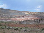
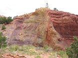
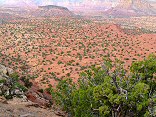
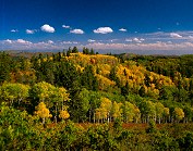
#img_9245
Morrison Formation south of Moore Road |
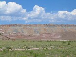 |
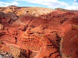
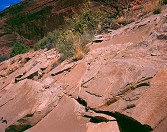
#img_9234
Foreground Morrison formation painted hills, behind them the Coal Cliffs of the Molen Reef |
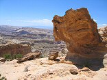 |
#img_9145
Stone formation, head of Poor Canyon The Dike |
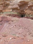 |
#img_8949
An adit at the top of the Chinle formation, south of Lucky Strike |
 |
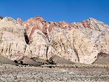
#img_8915
Multicolored Chinle formations, Sulfur Canyon |
 |
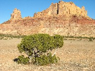
#img_8653
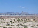
From Big Wild Horse Mesa, Factory Butte and the colorful Chinle formation below Skylline Rim in front of the Butte. |
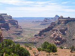 |
#img_8275
The interior of the northen Swell form the north shoulder of Cow Canyon |
 |
#img_8198
The Reef in the background, the Curtis (ledgy) and Summerville (sloped) formations in the foreground. |
 |
#img_8197
The bulk of the Swell that appears to be a point at Greasewood Canyon, as seen from the south of the Squeeze Note the size of the Reef (formed by the Grand Canyon Group) relative to the interior of the Swell, made of the Perminan Group), a difference of 1700 feet |
 |
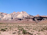
#img_8183
The Uneva Mine Canyon, second canyon south of I-70. Note the Navajo and Wingate formations, and in back, the Coconino sandstone, same formation that makes the Black Box. |
 |
#img_8180
The Grand Canyon Group on end: Carmel, Navajo, Kayenta, Wingate formations. |
 |
#img_8096
Cistern Canyon drainage (Moenkopi formation) Behind the Reef road San Rafael Swell |
 |
#img_8095
Cistern Canyon drainage (Moenkopi formation) Behind the Reef road San Rafael Swell |
 |
#img_8094
Cistern Canyon drainage (Moenkopi formation) Behind the Reef road San Rafael Swell |
 |
#img_8093
Cistern Canyon drainage (Moenkopi formation) Behind the Reef road San Rafael Swell |
 |
#img_8088
Cistern Canyon drainage (Moenkopi formation) Behind the Reef road San Rafael Swell |
 |
#img_8040
Layered Moenkopi formation Just north of Family Butte San Rafael Swell |
 |
#129-2956
Some strange-looking man-made formations near the Tropic Reservoir |
 |
#128-2862
Morinings were windless, so smoke form the fire settled into the Canyons. The lights of Tropic Utah are just visible |
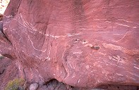 |
#2319
Striated sandstone formations |
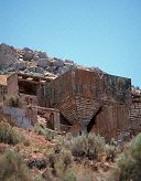 |
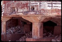
#a011-33
Shots form an old ore processing plant, SW of Goshen Utah. |
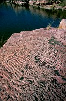 |
#a072-12
"Rocks and Waves"
This is Sioux Quartzite. It was layed down 2 million years ago on the bottom of a shallow lake. Due to silting, the wave pattern formed during mild times were preserved throughout the yearly floods. This patterned sand was compressed into the rock you see Palisades State Park Near Garretson SD |
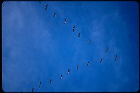 |
#272-20
Geese in formation flying South |
 |
#1847
Shots form the Bruce, SD Honey Days parade. |
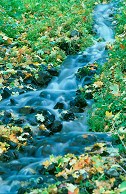 |
#2256
Small stream (originating form a spring) Maple Bench campground Payson Canyon UT |
 |
#2318
One of the Towers, sillouettes of sandstone formations, and the hiking trail barely visible at the base. |
 |
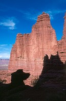
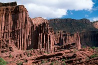
#2415
Rock formations, including the Cobra Fisher Towers |
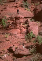 |
#2411
Two other hikers on the trail, giving a sence of the size of these sandstone formations. He is standing on a very small rise in comparison to the towers. Fisher Towers |
 |
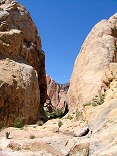
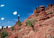
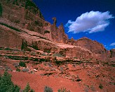
#2325
Rock formations, Titan, part of the cirque at the trail end |
 |
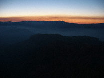
#282-1
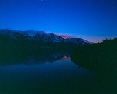
Sunset, Mt, Nebo, form Mona Lake |
 |
#312-4
Layers in the Navajo sandstone formation Arches National Park |
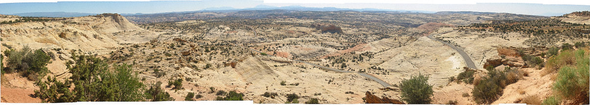 |
#127-2781
Panorama form the Over-the-Rocks lookout, highway 12 |
 |
#1821
Some shots form the old Iron or aluminum mill by Goshen. |
 |
#2329
To the East of the trail end, inaccesible by formal trail Fisher Towers |
Results from the Comments:
 |
Maxim
of Ohio
thought on 10/30/2005 that this photo was okay
and added the following: |
 |
F. Riddle
thought on 6/19/2005 that this photo was superb
and added the following: |
 |
Cemal Ekin
of Rhode Island
thought on 11/24/2002 that this photo was superb
and added the following: |
 |
Bruce Wilson
thought on 4/7/2001 that this photo was superb
and added the following: |
Results from the old catalog:
This search is a simple search for a word that appears somewhere in the database.
It is best to search a single word only. Multiple words are treated as OR.
If you find photos in the photographs section, you might want to look at
all the photographs in that photos directory to find similar matches.
Click here to list all keywords in the
database.
Click here to list the most popular photos in the
database.