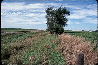
Barn along Indian Creek, south of the campground

Query = 'long'
Note that private photos will not be listed below unless you have logged in.
Results from the Directory listing:
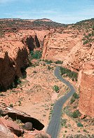
| 2002/Nov03 | Long Canyon, Circle Cliffs, Capitol Reef, along the Burr Trail (LF) | |
| 2002/Jun06 | Climbers at Fisher Towers, LF & 35mm shots around Bryce Canyon NP. Around Utah S-12, Devil's Garden, Long Canyon, Boulder Mountain, Spanish Fork. | |
| 2002/May29 | Digital shots at Bryce Canyon NP, Devils Garden (Grand Staircase-Escalante Monument), and Long Canyon (Burr Trail) |
Results from the Photographs listing:
|
|
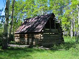
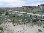
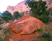
#img_9264
Barn along Indian Creek, south of the campground |
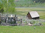 |
#img_9252
Old homested along the Upper Joe's Valley Road |
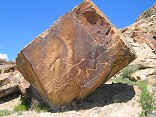 |
#img_9235
Petroglyphs along the Morre Road |
 |
#img_8750
The Hunt ranch, where cows, sheep, and chickens were raised, along with hay and corn for feed, all watered by the Muddy |
 |
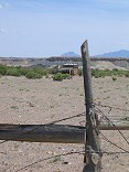
#img_8425
Corral along Moore Road |
 |
#img_8409
As close as I could get to one of the long-tailed wild horses in the Swell McKay Flat |
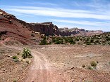 |
#img_8389
Behind the Reef Road. This road goes all the way along the visible cliffs |
 |
#img_6415
Along the Wardsworth Peak trail, South of Strawberry Peak |
 |
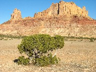
#458-1
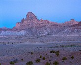
Window blind peak, bottleneck peak, assembly hall peak Turkey audible. Winter sun shines up valley/flats giving more even illumination and more dramatic angle. along mex mt rd, 1/4 mile further along |
 |
#457-3
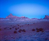
Window blind peak along mex mt rd |
 |
#457-2
Window blind peak, bottleneck peak, assembly hall peak along mex mt rd |
 |
#460-2
View nw along mex mt rd low bench above swayses leap turnoff |
 |
#464-4
Cliffs along mexican mountain rd fule rise West Jackass benches south of mex mt (above Swasey's leap turnoff) |
 |
#img_4768
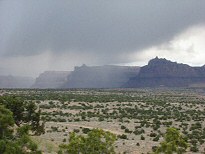
Rain along the Mexican Mountain road |
 |
#410-1
Side canyon, from hill Full possible rise Long Canyon, Burr Trail |
 |
#410-2
Side canyon, green maple Long Canyon, Burr Trail |
 |
#408-3
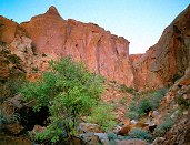
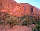
Circle cliffs Tilted down a bit. End of Long Canyon, Burr trail, on boulder |
 |
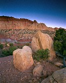
#411-1
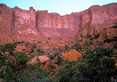
Circle cliffs w/boulders full sun, too much contrast End of Long Canyon, Burr trail, on boulder |
 |
#406-4
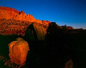
Circle cliffs w/boulders Shot 5 sec. End of Long Canyon, Burr trail, on boulder |
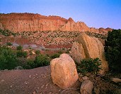 |
#406-3
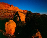
Circle cliffs w/boulders 20 sec metered, shot 26 sec. End of Long Canyon, Burr trail, on boulder |
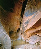 |
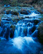
#407-4
Dry narrows (CNYN), pool at end Metered at 20 sec, shot 45 sec. Canyon faces SE Long Canyon, Burr Trail |
 |
#408-1
Dry narrows (CNYN) Metered at 6 sec, shot 12 sec. Long Canyon, Burr Trail |
 |
#411-3
Crack in wall, full height Long Canyon, Burr Trail |
 |
#411-4
Crack in wall Long Canyon, Burr Trail |
 |
#407-3
Tree on ledge Long Canyon, Burr Trail |
 |
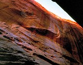
#408-2
Dykinga et all Long Canyon, Burr Trail |
 |
#408-4
Cut-out wall Long Canyon, Burr Trail |
 |
#407-1
Juniper, big rocks, wall Long Canyon, Burr Trail |
 |
#407-2
Water-worn rock, dead, tall weed Long Canyon, Burr Trail |
 |
#410-3
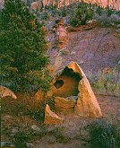
Hollowed-out rock Long Canyon, Burr Trail |
 |
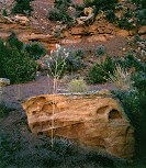
#409-1
Big orange rock Long Canyon, Burr Trail |
 |
#410-4
Bigl drainage, Juniper, rock with holes Long Canyon, Burr Trail |
 |
#409-3
Bigl drainage, bush, hoodoo Long Canyon, Burr Trail |
 |
#127-2745
Navaho sandstone domes along the Burr trail |
 |
#127-2718
Shot from one of the overlooks along the Boulder-to-Escalante section of Highway 12 Calf Creek |
 |
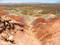
#127-2702
The Southern end of the grand gulch. These are the edges of upturned layers of rock, the upper layers have eroded long ago, leaving only a small ridge. I'm standing at the Strike Valley overlook, perched atop a 45 degree layer of Navajo sandstone. |
 |
#126-2689
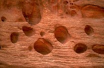
More swiss cheese erosion along the Strike Valley Overlook road |
 |
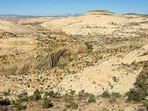
#126-2648
Long Canyon overlook, Burr trail |
 |
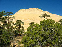
#124-2428
Long Canyon Homestead Viewpoint, Highway 12, Boulder Mountain |
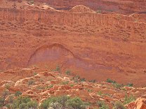 |
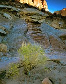
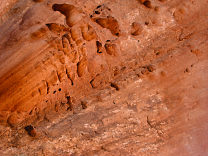
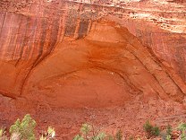
#124-2422
Wall, swiss cheese holes carved by the stream Long Canyon Burr Trail Utah |
 |
#124-2419
Rock Cove Long Canyon Burr Trail Utah |
 |
#2040
...by going to every place where longitude and latitude lines cross. Looking West |
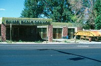 |
#175v-36
"Silver Maple Service", long closed. Nephi Utah |
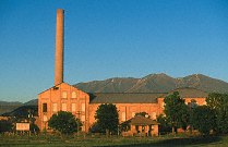 |
#356-23
Mill along I-15 Spanish Fork Utah |
 |
#350-30
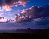
What follows are many shots at the Bryce overlooks along the road up from Rainbow Point Bryce Canyon National Park |
 |
#a108-23
Along the Alpine Loop Scenic Highway, between Sundance Ski Resort and American Fork Canyon. |
 |
#a012-07
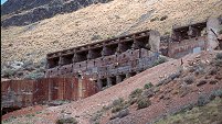
The long block house is probably where the ore cruchers were. |
 |
#352-11
Along S-12 near Escalante |
 |
#354-28
"Swiss Cheese", Long Canyon Burr Trail |
 |
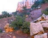
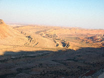
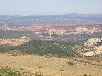
#355-08
Long Canyon overlook, North end of Long Canyon, toward the Circle Cliffs and the Henry Mountains |
 |
#355-20
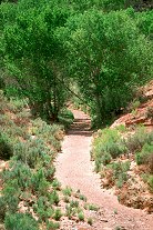
Streambed, Long Canyon Burr Trail |
 |
#355-33
Views along S-12 on Boulder Mountain |
 |
#127-2780
Panorama along the trail leading down to the Dry Fork of the Coyote (below are the Narrows, and three slot canyons) |
 |
#357-1
Long Canyon overlook, North end of Long Canyon, toward the Circle Cliffs and Capitol Reef |
 |
#369-4
Shots in and along the Navajo Loop Trail |
 |
#374-2
Along the Alpine Loop |
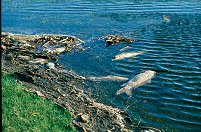 |
#a104-16
After the Spring thaw, many large fish were found dead, more than the usual, perhaps owing to the unusually cold and long winter this year. Oakwood Lake W. of Bruce South Dakota |
 |
#355-24
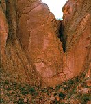
Long Canyon Burr Trail |
Results from the Comments:
 |
Maxim
of Ohio
thought on 10/30/2005 that this photo was okay
and added the following: |
 |
Maxim
of Ohio
thought on 10/30/2005 that this photo was good
and added the following: |
 |
Bruce Wilson
of Provo, Utah
thought on 10/20/2004 that this photo was displayed properly
and added the following: |
Results from the old catalog:
This search is a simple search for a word that appears somewhere in the database.
It is best to search a single word only. Multiple words are treated as OR.
If you find photos in the photographs section, you might want to look at
all the photographs in that photos directory to find similar matches.
Click here to list all keywords in the
database.
Click here to list the most popular photos in the
database.