Moore Road: gypsum mine, Red Ledges, Coal Cliffs (Molen Reef), cliffs of the Wasatch Pleatau above Ferron

Query = 'mine'
Note that private photos will not be listed below unless you have logged in.
Results from the Directory listing:
No matches.Results from the Photographs listing:
|
|
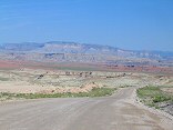
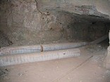
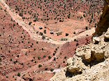
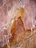
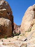
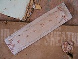
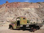
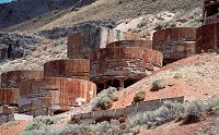
#img_9250
Moore Road: gypsum mine, Red Ledges, Coal Cliffs (Molen Reef), cliffs of the Wasatch Pleatau above Ferron |
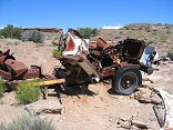 |
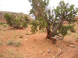
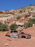
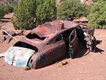
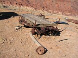
#img_8995
Old mine truck at the Cistern mine |
 |
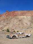
#img_8962
Dirty Devil mine, on Tomsich Butte |
 |
#img_8938
Mine in a canyon south of the Lucky Strike |
 |
#img_8928
Inside one of the adits at the Lucky Strike Mine |
 |
#img_8926
One-holer on the road to the Lucky Strike Mine |
 |
#img_8373
Road into the Lucky Strike Mine |
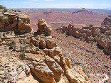 |
#img_8372
Reds Canyon and Hondu Country, from above the Lucky Strike Mine |
 |
#img_8371
The Lucky Strike Mine |
 |
#img_8329
Mine of the west side of the Green Vein Mesa |
 |
#img_8327
Mine in the Green Vein Mesa area |
 |
#img_8193
Uneva Mine Canyon |
 |
#img_8192
Uneva Mine Canyon |
 |
#img_8187
Looking down out of Uneva Mine Canyon |
 |
#img_8186
Swiss Cheese in Uneva Mine canyon |
 |
#img_8184
Farther up the Uneva Mine canyon. Wingate sandstone on the walls, and Coconino sandstone making up the bulge of the Swell in the center. |
 |
#img_8183
The Uneva Mine Canyon, second canyon south of I-70. Note the Navajo and Wingate formations, and in back, the Coconino sandstone, same formation that makes the Black Box. |
 |
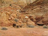
#img_8086
Cistern Mine, South of Bell Canyon Behind the Reef road San Rafael Swell |
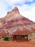 |
#img_8070
Vanadium King Mine office Temple Mountian San Rafael Swell |
 |
#img_8045
One of the main shafts, Lucky Strike Mine Reds Canyon San Rafael Swell |
 |
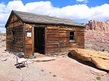
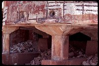
#img_8044
Worker pegboard, Lucky Strike Mine Reds Canyon San Rafael Swell |
 |
#img_8033
Green Vein Mesa mine? North end of Reds Canyon San Rafael Swell |
 |
#img_8032
Green Vein Mesa mine? North end of Reds Canyon San Rafael Swell |
 |
#img_8031
Green Vein Mesa mine? North end of Reds Canyon San Rafael Swell |
 |
#img_7958
Truck, and Calf Mesa Mine in the background, upper left San Rafael Swell |
 |
#img_7671
Black Dragon mine camp |
 |
#img_7500
At the Dexter mine, Calf Mesa |
 |
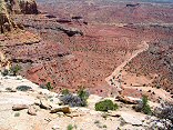
#img_4661
The canyons of th enorthern San Rafael. Window Blind Peak is prominent. |
 |
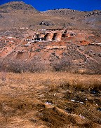
#1821
Some shots form the old Iron or aluminum mill by Goshen. |
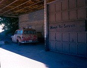 |
#honk
Honk for Service, old gas station and mine vehicle Eureka UT |
 |
#l127-26
Old mineworks. Goshen UT |
 |
#v116-04
West of Goshen UT |
 |
#1708
Mine tailings in Sunshine Canyon, Utah. These were left by the Sunshine mine near 1900. |
 |
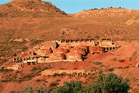
#a012-08
This was a gravity-fed plant. I presume there is a mine above the plant. |
 |
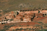
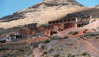
#272-2
Ore processing plant near Goshen |
Results from the Comments:
 |
Mike Davies
of Salt Lake City
thought on 11/11/2005 that this photo was good
and added the following: |
 |
eminem
thought on 4/30/2001 that this photo was displayed properly
and added the following: |
Results from the old catalog:
This search is a simple search for a word that appears somewhere in the database.
It is best to search a single word only. Multiple words are treated as OR.
If you find photos in the photographs section, you might want to look at
all the photographs in that photos directory to find similar matches.
Click here to list all keywords in the
database.
Click here to list the most popular photos in the
database.