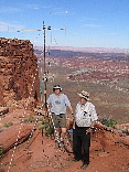
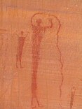
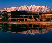
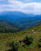
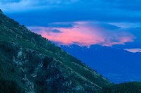
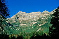
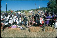
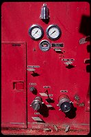
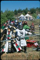
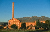
KA7OEI and K7HFV at the Panorama Point receive site
Glen Canyon Rec Area

Query = 'pan'
Note that private photos will not be listed below unless you have logged in.
Results from the Directory listing:
| 2005/July20 | A few shots at Panorama Point (Glen Canyon), and at the rock crawling area, south end of Lake Mountain. | |
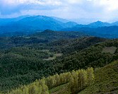
| 2002/Jun06 | Climbers at Fisher Towers, LF & 35mm shots around Bryce Canyon NP. Around Utah S-12, Devil's Garden, Long Canyon, Boulder Mountain, Spanish Fork. | |
| 2002/Feb09 | Digital camera shots around Spanish Fork Utah, including some trains. |
Results from the Photographs listing:
|
|
#img_0425
KA7OEI and K7HFV at the Panorama Point receive site Glen Canyon Rec Area |
 |
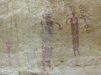
#img_8277
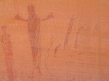
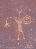
Buckhorn Wash pictographic panel |
 |
#img_8276
Near the center: the Buckhorn Wash pictographic panel, shot from the North shoulder of Calf Canyon |
 |
#img_8118
Panel detail Buckhorn Wash Pictograph panel San Rafael Swell |
 |
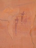
#img_8116
Panel detail Buckhorn Wash Pictograph panel San Rafael Swell |
 |
#img_8115
Panel detail Buckhorn Wash Pictograph panel San Rafael Swell |
 |
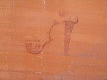
#img_8114
Buckhorn Wash pictograph panel detail Buckhorn Wash San Rafael Swell |
 |
#img_8112
Buckhorn Wash pictograph panel detail Buckhorn Wash San Rafael Swell |
 |
#477-3
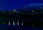
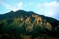
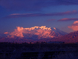
UVSC and Mt. Timpanogus early alpenglow Ponds, SW corner Orem Utah |
 |
#485-1
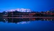
UVSC and Mt. Timpanogus dark stripe on timp Ponds, SW corner |
 |
#477-2
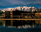
UVSC and Mt. Timpanogus Ponds, SW corner Orem Utah |
 |
#475-2
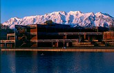
UVSC and Mt. Timpanogus Ponds, SW corner |
 |
#474-3
UVSC and Mt. Timpanogus Ponds, SW corner Orem Utah |
 |
#474-2
UVSC and Mt. Timpanogus Ponds, SW corner Orem Utah |
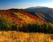 |
#470-3
Sage, hillside, Spanish Fork peak, midground maple=orange far end of Wadsworth Peak trail Right Fork of Hobble Creek Canyon |
 |
#467-1
looking south, powerhouse, spanish fork, nebo mtns Strawberry peak |
 |
#466-1
Mt Nebo, spanish fork peak Twin peaks, near stra berry pk |
 |
#466-2
Provo peak, Cascade mtns, Mt Timpanogus Strawberry peak |
 |
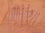
#img_4864
Pictograph panel Head of Sinbad |
 |
#388-2
Dead fish, mudpan flies wings made blue by pol. Mona reservoir |
 |
#121-2200
Bishop's storehouse, now museum Panguitch Utah |
 |
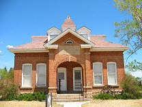
#114-1428_img
The old station in Spanish Fork was used for a time as a train union lodge hall. Spanish Fork UT |
 |
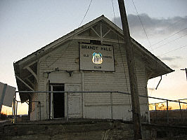
#113-1345_img
Old station (next to the Utah Livestock Auction) Near Spanish Fork UT |
 |
#113-1335_imga
Mt. Timpanogus, morning light Provo UT |
 |
#v129-12
Pink alpenglow on clouds, mountains. East of Spanish Fork UT |
 |
#n057a7
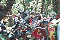
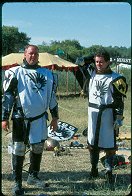
In Japanese armour is Lord Ivan Peterovitch of Shattentor. |
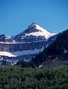 |
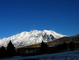
#a110-07
Mount Timpanogus |
 |
#172v-02
Mt. Timpanogus, late day. |
 |
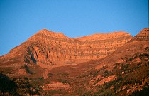
#173v-21
The 'back' (North) side of Mt. Timpanogus. |
 |
#n056-16
Lord Marcus of Shadewes Company. |
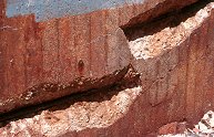 |
#a012-31
The salt causes the iron rebar to expand, blowing out chunks of concrete over the rebar. |
 |
#2179
Lt. Moth and Father Tyresius of Company Nevermore |
 |
#2165
Company Nevermore on the left side of the frame, deploying from reserve to engage the south end of the bridge. |
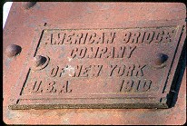 |
#209-21
American Bridge Company of New York, U.S.A., 1910 DM&E bridge, East of Volga SD |
 |
#b048-29
Shadewes Company. |
 |
#1840
|
 |
#296-05
Water Control Panel, Bushnell SD |
 |
#2141
Company Nevermore before the field battle |
 |
#173v-30
The North side of Mt. Timpanogus, the survey shack on the summit barely visible. |
 |
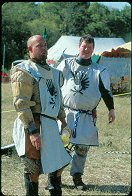
#2189
Modred Blackhorse, Gareth the Black and Rodney of Wendigo of Company Nevermore, finding shade by the haybales. |
 |
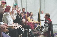
#2172
Prince Tristan of Northshield and Captain Sebastian of Company Nevermore |
 |
#2178
Thane Juan and Modred Blackhorse of Company Nevermore |
 |
#127-2781
Panorama form the Over-the-Rocks lookout, highway 12 |
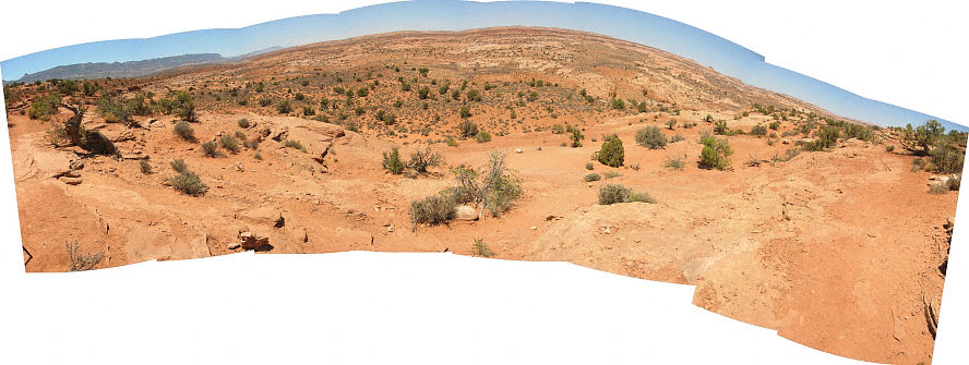 |
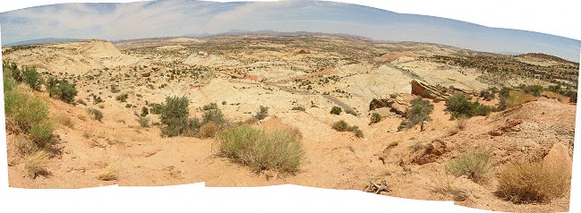
#127-2780
Panorama along the trail leading down to the Dry Fork of the Coyote (below are the Narrows, and three slot canyons) |
 |
#356-23
Mill along I-15 Spanish Fork Utah |
 |
#122-3
Panorama, Navajo Sandstone Overlook, Utah Highway 12 South of Escalente Utah |
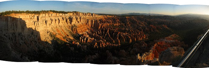 |
#122-2
Sunrise Panorama Bryce Point Bryce Canyon National Park Utah |
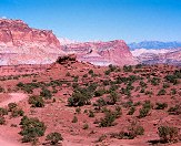 |
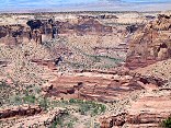
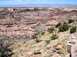
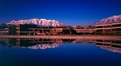
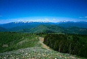
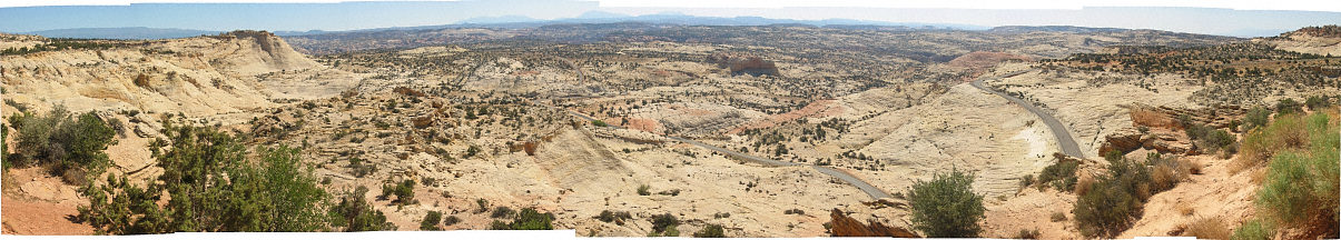
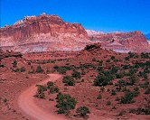
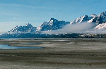
#328-3
Panorama Point Capitol Reef National Park |
 |
#281-2
Show-off rocket, Spanish Fork race course. |
 |
#327-4
Panorama Point Capitol Reef National Park |
 |
#196v-18
North cirque, Mt. Timpanogus peak |
 |
#114-1408_img
Mt. Timpanogus Shot from Spanish Fork UT |
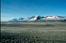 |
#270-22
The vast mud pan left by the diminishing Lake Jackson, Teton range in the background. Teton N.P., North end WY |
 |
#270-20
Part of the vast mud pan left by the diminishing Lake Jackson, Teton range in the background. Teton N.P., North end WY |
 |
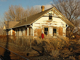
#265-3
This old house is made of 2x4's, all laid flat to make the walls. A very strange method of construction. lakeside, west of Spanish Fork Utah |
 |
#2325
Rock formations, Titan, part of the cirque at the trail end |
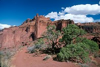 |
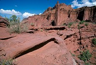
#2324
Wide-angle view of the towers from the far end of the 2.2 mile trail. Titan is in the center of the frame. Bring plenty of water, you'll want to spend some time out there. Fisher Towers BLM area Moab UT |
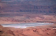 |
#2382
Salt drying pans East of Dead Horse Point UT |
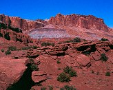 |
#328-2
Panorama Point Capitol Reef National Park |
Results from the Comments:
 |
Bruce Wilson
of Provo, Utah
thought on 2/26/2005 that this photo was displayed properly
and added the following: |
Results from the old catalog:
This search is a simple search for a word that appears somewhere in the database.
It is best to search a single word only. Multiple words are treated as OR.
If you find photos in the photographs section, you might want to look at
all the photographs in that photos directory to find similar matches.
Click here to list all keywords in the
database.
Click here to list the most popular photos in the
database.