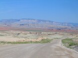
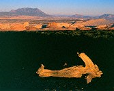
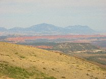
Moore Road: gypsum mine, Red Ledges, Coal Cliffs (Molen Reef), cliffs of the Wasatch Pleatau above Ferron

Query = 'reef'
Note that private photos will not be listed below unless you have logged in.
Results from the Directory listing:
| 2004/Mar28 | San Rafael digital shots, including Behind the Reef road and Reds Canyon. | |
| 2003/Oct25 | Fall colors on Strawberry Peak, West Reef of San Rafael Swell | |
| 2002/Nov03 | Long Canyon, Circle Cliffs, Capitol Reef, along the Burr Trail (LF) | |
| 2002/May20 | LF: Bryce N.P., Capitol Reef N.P., Fisher Towers, Mona Reservoir | |
| 2002/May11 | Digital shots: Cisco Utah, Goblin Valley State Park, San Rafael Swell, Bryce Canyon National Park, Capitol Reef National Park, Fisher Towers |
Results from the Photographs listing:
|
|
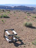
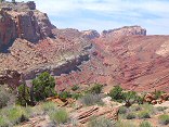
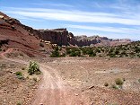
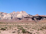
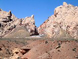
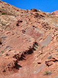
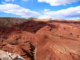
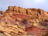
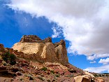
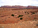
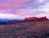
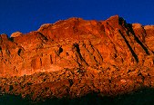
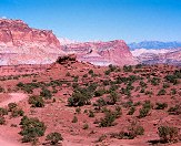
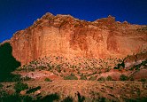
#img_9250
Moore Road: gypsum mine, Red Ledges, Coal Cliffs (Molen Reef), cliffs of the Wasatch Pleatau above Ferron |
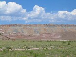 |
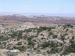
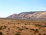
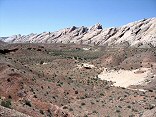
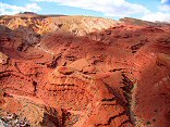
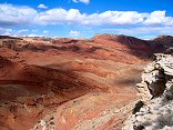
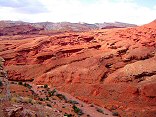
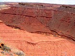
#img_9234
Foreground Morrison formation painted hills, behind them the Coal Cliffs of the Molen Reef |
 |
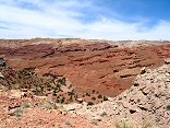
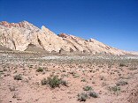
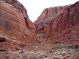
#img_8971
Baptist Draw and the Reef |
 |
#img_8650
The southern Reef from Big Wild Horse mesa, by the Huntsville Chevron #1 drill hole. |
 |
#img_8605
The Reef from Flat Top |
 |
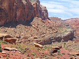
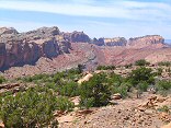
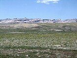
#img_8407
Looking across Sinbad Country to the southern Reef |
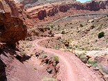 |
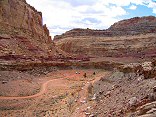
#img_8401
Behind the Reef road descends in to Ramp canyon |
 |
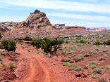
#img_8399
Behind the Reef Road ATV trail |
 |
#img_8395
The Behind the Reef road climbs the Kayenta ledge high above the red Moenkopi ledges of the Cistern Canyon |
 |
#img_8392
The Behind the Reef Road descends a slope of loose boulders |
 |
#img_8391
From the Behind the Reef Road, the red Moenkopi shleves, and beyond that the Kaibab limestone benches of the Swell interior |
 |
#img_8390
In the distance the Behind the Reef road climbs up the Kayenta shelf. Above is the Navajo, and below is the oddly-sloped Wingate. Below that is the Chinle/Moenkopi valley |
 |
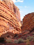
#img_8389
Behind the Reef Road. This road goes all the way along the visible cliffs |
 |
#img_8388
Wildly eroded butte Behind the Reef Road |
 |
#img_8385
Navajo hoodoos in Little Wild Horse Canyon, near the Behind the Reef Road |
 |
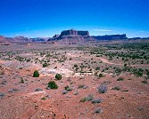
#img_8311
The Reef north of Tidwell Draw |
 |
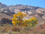
#img_8307
Phacelia East of the Reef |
 |
#img_8306
Yellow beeplant Cleome lutea East of the Reef |
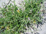 |
#img_8305
Must-mustard Chorispora tenella East of the Reef |
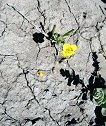 |
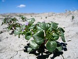
#img_8304
Camissonia (in the evening primrose family) East of the Reef |
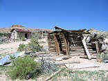 |
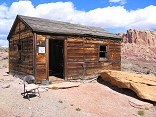
#img_8298
The Smith homestead, just outside the Reef |
 |
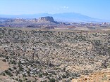
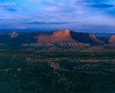
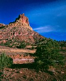
#img_8296
Mexican Mountain and the interior of the Reef |
 |
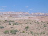
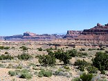
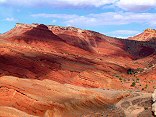
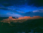
#img_8198
The Reef in the background, the Curtis (ledgy) and Summerville (sloped) formations in the foreground. |
 |
#img_8197
The bulk of the Swell that appears to be a point at Greasewood Canyon, as seen from the south of the Squeeze Note the size of the Reef (formed by the Grand Canyon Group) relative to the interior of the Swell, made of the Perminan Group), a difference of 1700 feet |
 |
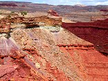
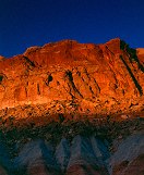
#img_8182
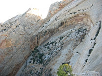
The reef: the red Carmel, and the white navajo. |
 |
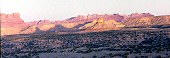
#img_8179
The reef north of I-70. Note that is shallows to the north. |
 |
#img_8176
I-70 starts up Spotted Wolfe Canyon through the Reef. |
 |
#img_8174
The Reef south of I-70. Note the increase of the pitch as the reef goes south. |
 |
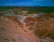
#img_8101
The last climb down (or the first climb up going north) Behind the Reef road San Rafael Swell |
 |
#img_8100
Wingate sandstone Behind the Reef road San Rafael Swell |
 |
#img_8098
Behind the Reef Road ATV trail Behind the Reef road San Rafael Swell |
 |
#img_8097
Navajo sandstone erosion Behind the Reef road San Rafael Swell |
 |
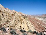
#img_8096
Cistern Canyon drainage (Moenkopi formation) Behind the Reef road San Rafael Swell |
 |
#img_8095
Cistern Canyon drainage (Moenkopi formation) Behind the Reef road San Rafael Swell |
 |
#img_8094
Cistern Canyon drainage (Moenkopi formation) Behind the Reef road San Rafael Swell |
 |
#img_8093
Cistern Canyon drainage (Moenkopi formation) Behind the Reef road San Rafael Swell |
 |
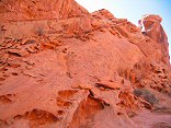
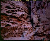
#img_8092
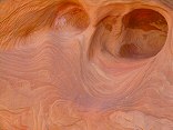
Slot Canyon swiss cheese, Cistern Canyon Behind the Reef road San Rafael Swell |
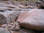 |
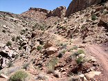
#img_8091
One of the small problems one encounters on the ATV trail Cistern Canyon bottom, Behind the Reef road San Rafael Swell |
 |
#img_8089
Cistern Canyon enters the Reef Behind the Reef road San Rafael Swell |
 |
#img_8088
Cistern Canyon drainage (Moenkopi formation) Behind the Reef road San Rafael Swell |
 |
#img_8087
Behind the Reef road San Rafael Swell |
 |
#img_8086
Cistern Mine, South of Bell Canyon Behind the Reef road San Rafael Swell |
 |
#img_8083
Navajo sandstone block Behind the Reef road San Rafael Swell |
 |
#img_8082
Behind the Reef road San Rafael Swell |
 |
#img_8081
Hondu Country Behind the Reef road San Rafael Swell |
 |
#img_8080
Chute Canyon exits the Reef Behind the Reef road San Rafael Swell |
 |
#img_8079
Inside the San Rafael Reef, at Crack and Chute Canyons Behind the Reef road San Rafael Swell |
 |
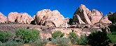
#img_8078
Inside the San Rafael Reef, at Crack and Chute Canyons Behind the Reef road San Rafael Swell |
 |
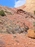
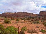
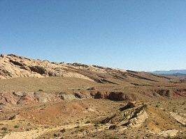
#img_7685
The east side of the Reef |
 |
#459-4
the reef, west side slope just above second gate on mexican mt rd |
 |
#457-4
reef tooth, between river exit and black dragon canyons jackass bench, northernmost point |
 |
#463-1
San Rafael Reef West Jackass benches south of mex mt (above Swasey's leap turnoff) |
 |
#463-2
San Rafael Reef West Jackass benches south of mex mt (above Swasey's leap turnoff) |
 |
#448-1
mexican mountain, san rafael reef (west side) second gate, mex. mt. rd., on cliff. |
 |
#406-2
Organ, teeth, 35.5 f/stops Capitol reef? south end, by Muley twist |
 |
#406-1
white cliffs Southern Tarantula mesa, from border of Capitol reef and GS-E |
 |
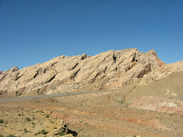
#127-2709
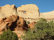
One small section of the Navajo sandstone "teeth" on the Western edge of the Grand Gulch. Strike Valley Overlook Capitol Reef National Park |
 |
#126-2671
Peek-a-boo rock (?), on the Strike Valley Overlook 4WD road Capitol Reef National Park |
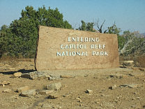 |
#126-2670
Capitol Reef sinage at the Burr Trail entrance |
 |
#124-2429
Henry Mountains and Capitol Reef Homestead Viewpoint, Highway 12, Boulder Mountain |
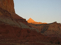 |
#119-1924_img
Fern's Nipple, in all it's magnificence Capitol Reef National Park |
 |
#118-1829_img
San Rafael Reef, neat I-70 |
 |
#118-1828_img
San Rafael Reef, neat I-70 |
 |
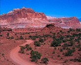
#330-1
Capitol Reef National Park |
 |
#327-4
Panorama Point Capitol Reef National Park |
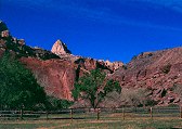 |
#328-1
Fruitia, Capitol Reef |
 |
#328-2
Panorama Point Capitol Reef National Park |
 |
#328-3
Panorama Point Capitol Reef National Park |
 |
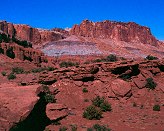
#328-4
Capitol Gorge, Capitol Reef National Park |
 |
#357-1
Long Canyon overlook, North end of Long Canyon, toward the Circle Cliffs and Capitol Reef |
 |
#329-4
A series shot at sunset on the Scenic Drive, stop #2 Capitol Reef National Park |
 |
#330-2
Curtain Capitol Reef National Park, Capitol Gorge |
 |
#332-2
Eph Hanks Tower, named after Ephraim Hanks, the first permanent settler in the Capitol Reef area Capitol Reef National Park |
 |
#332-4
Navajo Sandstone domes, outside of Capitol Reef N.P. |
 |
#329-3
Capitol Reef National Park |
Results from the Comments:
No matches.Results from the old catalog:
This search is a simple search for a word that appears somewhere in the database.
It is best to search a single word only. Multiple words are treated as OR.
If you find photos in the photographs section, you might want to look at
all the photographs in that photos directory to find similar matches.
Click here to list all keywords in the
database.
Click here to list the most popular photos in the
database.