
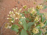
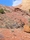
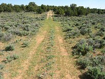
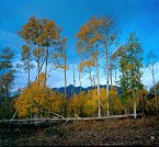
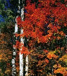
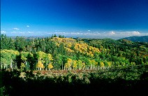
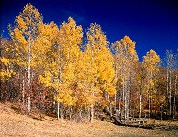
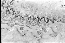
aspen on a hill full rise, someback tilt
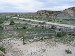
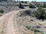
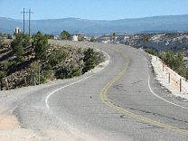
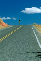
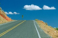
Miller Flat Road

Query = 'road'
Note that private photos will not be listed below unless you have logged in.
Results from the Directory listing:
| 2004/May23 | San Rafael Swell: Moore road, and south of I-70 (digital) | |
| 2004/Mar28 | San Rafael digital shots, including Behind the Reef road and Reds Canyon. | |
| 2002/Nov09 | Fall Scenics around Mt. Nebo Loop Road, and Alpine Scenic Loop Road. (LF) | |
| 2002/Jun19 | Waterpocket Fold, Burr Trail, Bryce Canyon, Alpine Loop Scenic Road |
Results from the Photographs listing:
|
|
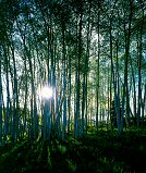
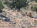
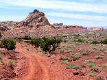
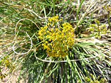
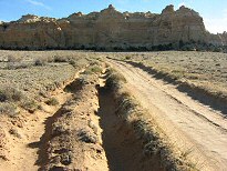
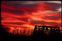
#485-3
aspen on a hill full rise, someback tilt Miller Flat Road |
 |
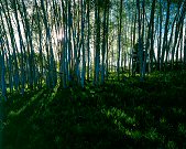
#485-4
aspen on a hill Miller Flat Road |
 |
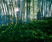
#478-1
aspen on a hill Miller Flat Road |
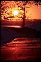
 |
#485-2
aspen on a hill Miller Flat Road |
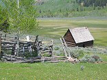 |
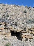
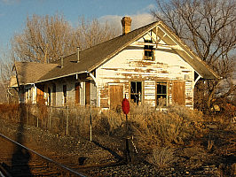
#img_9252
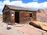
Old homested along the Upper Joe's Valley Road |
 |
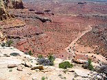
#img_9250
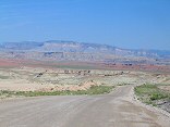
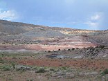
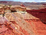
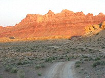
Moore Road: gypsum mine, Red Ledges, Coal Cliffs (Molen Reef), cliffs of the Wasatch Pleatau above Ferron |
 |
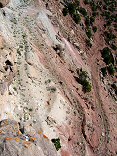
#img_9245
Morrison Formation south of Moore Road |
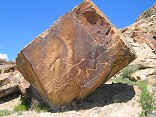 |
#img_9235
Petroglyphs along the Morre Road |
 |
#img_9233
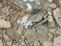
The desert blooms Moore Road |
 |
#img_8982
More fo the stone cairn road markers, and the only bit of the original road that I ever saw |
 |
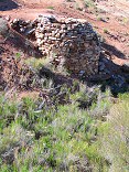
#img_8976
Stone cairns that mark an old road to the Blackwood and Nickols drill hole |
 |
#img_8934
Miniature canyonscape on the Reds Canyon road |
 |
#img_8926
One-holer on the road to the Lucky Strike Mine |
 |
#img_8749
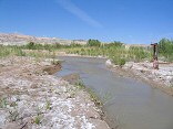
The ford across Muddy Creek. The Hunt's drove this road in from a mining road to the south. Vehicles cross from the lower left to the upper left by way of the kiosk. |
 |
#img_8558
...but only about 6 feet deep with two drill holes. Rod's Valley Road |
 |
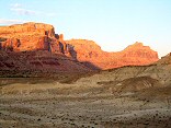
#img_8474
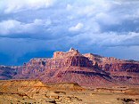
Eagle Canyon I-70 @ Moore Road exit |
 |
#img_8467
Red Ledges Entrada sandstone Moore Road |
 |
#img_8465
Moore Road |
 |
#img_8461
Moore Road |
 |
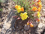
#img_8458
Primrose Moore Road |
 |
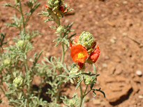
#img_8450
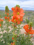
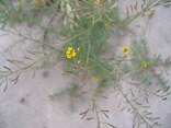
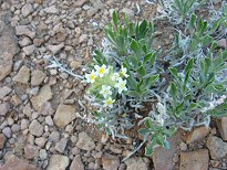
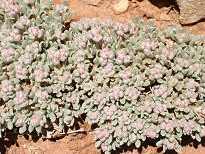
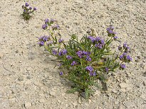
Desert Globemallow Moore Road |
 |
#img_8448
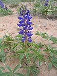
Desert Lupine Moore Road at Dry Wash |
 |
#img_8446
Moore Road at Dry Wash |
 |
#img_8442
Moore Road at Dry Wash |
 |
#img_8430
Moore road at Dry Wash |
 |
#img_8425
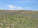
Corral along Moore Road |
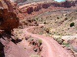 |
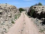
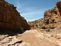
#img_8401
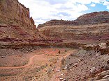
Behind the Reef road descends in to Ramp canyon |
 |
#img_8399
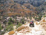
Behind the Reef Road ATV trail |
 |
#img_8395
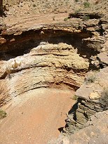
The Behind the Reef road climbs the Kayenta ledge high above the red Moenkopi ledges of the Cistern Canyon |
 |
#img_8392
The Behind the Reef Road descends a slope of loose boulders |
 |
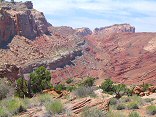
#img_8391
From the Behind the Reef Road, the red Moenkopi shleves, and beyond that the Kaibab limestone benches of the Swell interior |
 |
#img_8390
In the distance the Behind the Reef road climbs up the Kayenta shelf. Above is the Navajo, and below is the oddly-sloped Wingate. Below that is the Chinle/Moenkopi valley |
 |
#img_8389
Behind the Reef Road. This road goes all the way along the visible cliffs |
 |
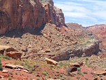
#img_8388
Wildly eroded butte Behind the Reef Road |
 |
#img_8385
Navajo hoodoos in Little Wild Horse Canyon, near the Behind the Reef Road |
 |
#img_8373
Road into the Lucky Strike Mine |
 |
#img_8328
From above, the road to the adit, Green Vein Mesa, just north of Family Butte |
 |
#img_8264
Water culvert, old railroad grade |
 |
#img_8263
Old railroad grade |
 |
#img_8261
A small cut of the railroad grade |
 |
#img_8259
One of the lime kilns near the old railroad grade |
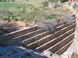 |
#img_8232
The dam at Sid's Hole. Note it is completely silted in. Cottonwood Wash Road |
 |
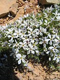
#img_8228
Lomatium junecium Lomatium junecium Cottonwood Wash road at Window Blind Peak |
 |
#img_8216
Cliffs above Mexican Mountain Road Near the Bridge campground |
 |
#img_8154
Lavandula evening-primrose Calyophus lavandulifolius Cottonwood Wash road |
 |
#img_8111
Phlox? Sulfur Springs road, Jackass Benches San Rafael Swell |
 |
#img_8101
The last climb down (or the first climb up going north) Behind the Reef road San Rafael Swell |
 |
#img_8100
Wingate sandstone Behind the Reef road San Rafael Swell |
 |
#img_8098
Behind the Reef Road ATV trail Behind the Reef road San Rafael Swell |
 |
#img_8097
Navajo sandstone erosion Behind the Reef road San Rafael Swell |
 |
#img_8096
Cistern Canyon drainage (Moenkopi formation) Behind the Reef road San Rafael Swell |
 |
#img_8095
Cistern Canyon drainage (Moenkopi formation) Behind the Reef road San Rafael Swell |
 |
#img_8094
Cistern Canyon drainage (Moenkopi formation) Behind the Reef road San Rafael Swell |
 |
#img_8093
Cistern Canyon drainage (Moenkopi formation) Behind the Reef road San Rafael Swell |
 |
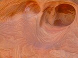
#img_8092
Slot Canyon swiss cheese, Cistern Canyon Behind the Reef road San Rafael Swell |
 |
#img_8091
One of the small problems one encounters on the ATV trail Cistern Canyon bottom, Behind the Reef road San Rafael Swell |
 |
#img_8089
Cistern Canyon enters the Reef Behind the Reef road San Rafael Swell |
 |
#img_8088
Cistern Canyon drainage (Moenkopi formation) Behind the Reef road San Rafael Swell |
 |
#img_8087
Behind the Reef road San Rafael Swell |
 |
#img_8086
Cistern Mine, South of Bell Canyon Behind the Reef road San Rafael Swell |
 |
#img_8083
Navajo sandstone block Behind the Reef road San Rafael Swell |
 |
#img_8082
Behind the Reef road San Rafael Swell |
 |
#img_8081
Hondu Country Behind the Reef road San Rafael Swell |
 |
#img_8080
Chute Canyon exits the Reef Behind the Reef road San Rafael Swell |
 |
#img_8079
Inside the San Rafael Reef, at Crack and Chute Canyons Behind the Reef road San Rafael Swell |
 |
#img_8078
Inside the San Rafael Reef, at Crack and Chute Canyons Behind the Reef road San Rafael Swell |
 |
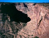
#img_8037
One steep part of the Devil's Racetrack. This was once the main road into the interior of the Swell. Devil's Racetrack San Rafael Swell |
 |
#img_7972
Cliffs above Mexican Mountain Road Lockhart Box San Rafael Swell |
 |
#img_7709
Eva Conover Road, from South Coal Wash to I-70 |
 |
#473-4
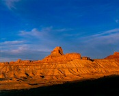
Windowblind peak, benches SW of the peak, on the road falloff Utah |
 |
#img_5241
Devils Hole Above Mexican Mountian road |
 |
#img_5163
One of the old roads on Cedar Mountain |
 |
#img_5134
Road to Sulfur Springs Trailhead |
 |
#img_5121
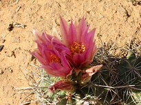
Sclerocactus parviflorus Mexican Mountain Road |
 |
#img_5120
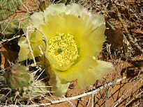
Prickly Pear Cactus Mexican Mountain Road |
 |
#img_5067
End of the trail, White Horse Canyon, below the road |
 |
#img_5064
White Horse Canyon, below the road |
 |
#img_5055
Desert Globemallow Mexican Mountain Road |
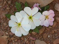 |
#img_5052
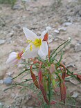
Evening Primrose, fully open Oenothera caespitosa? Mexican Mountain Road |
 |
#img_5037
Wild Onion Allium Mexican Mountain Road |
 |
#img_5034
Cryptantha Mexican Mountain Road |
 |
#img_4996
Desert Trumpet. The tall-standing stalk stays until trampled, leaving the desert scattered with veritcal pods with "feelers" Mexican Mountain Road |
 |
#img_4966
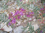
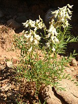
Milkvetch Astragalus Mexican Mountain Road |
 |
#img_4951
Buckwheat Eeiogonum Mexican Mountain Road |
 |
#img_4948
Milkvetch Astragalus Mexican Mountain Road |
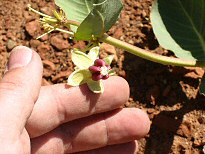 |
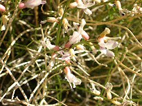
#img_4943
Pallid milkweed Ascepias cryptoceras Mexican Mountain Road |
 |
#img_4942
Yellow Cryptantha Mexican Mountain Road |
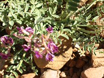 |
#img_4929
Crescent Milkvetch Mexican Mountain Road |
 |
#img_4863
Rutted road Head of Sinbad |
 |
#img_4768
Rain along the Mexican Mountain road |
 |
#img_4677
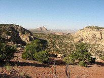
The cliffs east of Mexican Mountain Road Jackass Benches |
 |
#img_4646
Phacelia Castle Dale to Buckhorn Well road |
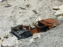 |
#img_4639
Decrepid cars tossed off the cliffs Castle Dale to Buckhorn Well road |
 |
#450-3
Goodwater canyon, looking North. Time uncertain. Entered when slide developed. Original entry lost? Main sideroad to East side of Goodwater cyn. |
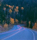 |
#434-4
Aspen and pine stand, road in foreground 90 sec metered, 3 min actual Nebo loop scenic drive |
 |
#424-2
Big aspen, nebo 11 sept road |
 |
#418-4
Maple & aspens, close pol. has no effect onleaves, only sky up high, sun 180 from camera Massive rise Blackhawk road, Nebo loop |
 |
#418-3
Maple & aspens Full rise, Blackhawk road, Nebo loop |
 |
#391-3
Old ranch/farm 5 sec didn't watch for traffic on road in background North of Nephi Utah Wpt114 Nephi Utah |
 |
#127-2792
Moving dirt from the cliff just around the corner (eroded down to the roadbed) to butress stream erosion here. |
 |
#127-2758
The million dollar road, Escalante to Boulder. |
 |
#126-2689
More swiss cheese erosion along the Strike Valley Overlook road |
 |
#126-2671
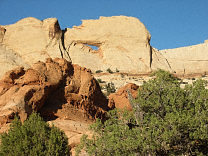
Peek-a-boo rock (?), on the Strike Valley Overlook 4WD road Capitol Reef National Park |
 |
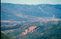
#123-2400
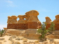
Goblins and Hoodoos (made of much harder sandstone than those in Goblin Valley or Bryce) Devils Garden Outstanding Nature Area 12 Miles off Utah Highway 12 next to the Hole-in-the-rock Road, Grand Staircase-Escalante Monument, |
 |
#a100-10
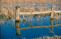
Flooded ditch burrows by the road. |
 |
#070-29
|
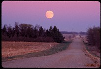 |
#203-20
Country road, moonrise. East of Pipestone MN |
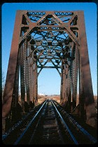 |
#209-10
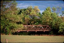
Bridge, DM&E line East of Volga SD |
 |
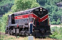
#229-34
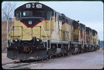
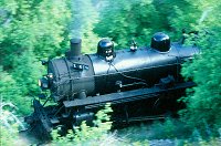
D&I Railroad Engines 26 (EMD GP9?) and 19 (EMD GP9). |
 |
#218-10
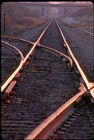
Tracks illuminated by the dawn, DM&E crossing 22nd Ave., Brookings SD. Brookings SD |
 |
#050-02
|
 |
#254-35
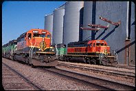
BNSF switchyard Garretson SD |
 |
#201v-11
U-turn (important) |
 |
#051-25
My favorite bridge Bridge, South end of 22nd ave. Brookings SD |
 |
#1710
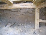
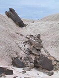
An old ore chute for getting ore into trucks at the roadbed. Ophir UT |
 |
#239-25
Echo Canyon I80 Utah |
 |
#217-02
DM&E bridge, sunset East of Volga SD |
 |
#051-08
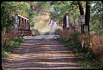
Bridge, once a major road out of town South End of 22nd Avenue Brookings SD |
 |
#a108-07
Heber Valley railroad (tourist) EMD engine. |
 |
#180v-16
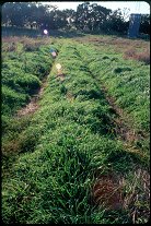
A portion of Skyline Drive. Mt. Nebo Scenic Loop Payson & Nephi UT |
 |
#201v-14
Bend (do not ignore) |
 |
#202v-27
Scenic from roadway, Mt. Nebo scenic loop (note very uneven effect of the polarizer with this wide-angle lens) |
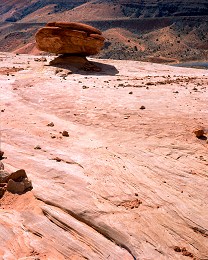 |
#224-3
Balanced rock on weathered Navajo sandstone Arches National Park (entrance road) Moab Utah |
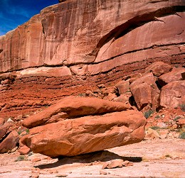 |
#223-1
Small balanced rock. Arches National Park (entrance road) Moab Utah |
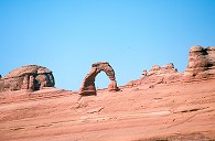 |
#2250
Delicate Arch from the viewpoint near the road. |
 |
#256-4
Spring Red Creek Flat, Nebo Loop Road |
 |
#350-30
What follows are many shots at the Bryce overlooks along the road up from Rainbow Point Bryce Canyon National Park |
 |
#358-3
Narrows, Dry Fork, Coyote Canyon Hole-In-The-Rock road |
 |
#248-01
Sunset during spring thaw, OLSP |
 |
#v116-19
The "Heeber Creeper", Heber Valley RailRoad Engine No. 618, a coal-fired 2-8-4. Provo Canyon Utah |
Results from the Comments:
 |
Andrew
thought on 2/25/2005 that this photo was superb
and added the following: |
|
|
Eric Carlson
of Crooks
thought on 7/28/2002 that this photo was very cool
and added the following: |
 |
Bruce Wilson
thought on 4/7/2001 that this photo was okay
and added the following: |
 |
Bruce Wilson
thought on 4/6/2001 that this photo was displayed properly
and added the following: |
Results from the old catalog:
This search is a simple search for a word that appears somewhere in the database.
It is best to search a single word only. Multiple words are treated as OR.
If you find photos in the photographs section, you might want to look at
all the photographs in that photos directory to find similar matches.
Click here to list all keywords in the
database.
Click here to list the most popular photos in the
database.