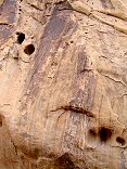
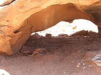
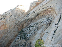
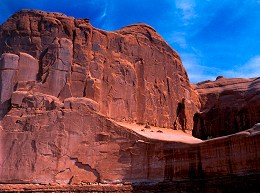
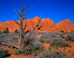
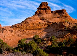
Sid and Charley (Entrada sandstone)

Query = 'stone'
Note that private photos will not be listed below unless you have logged in.
Results from the Directory listing:
| 2001/Nov06 | Large format photography: Teton N.P., Yellowstone N.P., Fall scenics, and some 35mm (page 6 & 7). | |
| 18Mar00 | Scenics around SD, geese in sunset, tombstone art, Brookings courthouse. | old |
| 07Mar00 | Scenics around SD, Pipestone MN, Madison SD | old |
Results from the Photographs listing:
|
|
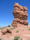
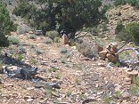
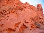
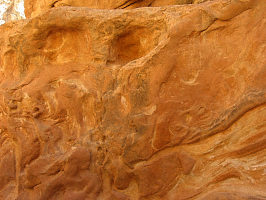
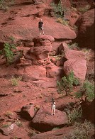
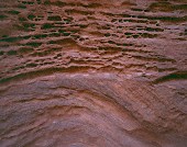
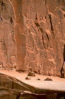
#img_9219
Sid and Charley (Entrada sandstone) |
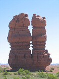 |
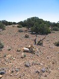
#img_9216
Sid and Charley (Entrada sandstone) |
 |
#img_9178
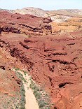
Lava boulders on Entrada sandstone Between Salt Wash and the Muddy, near Lone Tree Crossing |
 |
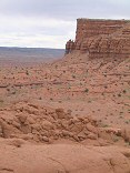
#img_9145
Stone formation, head of Poor Canyon The Dike |
 |
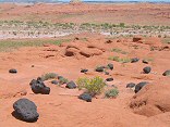
#img_8982
More fo the stone cairn road markers, and the only bit of the original road that I ever saw |
 |
#img_8976
Stone cairns that mark an old road to the Blackwood and Nickols drill hole |
 |
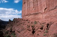
#img_8467
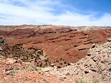
Red Ledges Entrada sandstone Moore Road |
 |
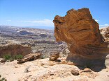
#img_8404
Sandstone erosion (Wingate?) in Ramp canyon |
 |
#img_8398
Cistern Canyon climbs up threough the red Moenkopi to the yellow kaibab limestone to the white Coconino sandstone |
 |
#img_8391
From the Behind the Reef Road, the red Moenkopi shleves, and beyond that the Kaibab limestone benches of the Swell interior |
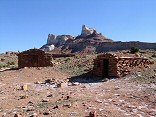 |
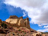
#img_8384
Stone Buildings at the base of Temple Mountain |
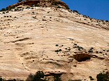 |
#img_8370
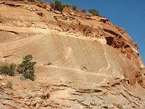
Navajo sandstone butte showing the aolian (windborne) corssbedding |
 |
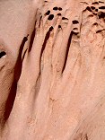
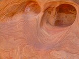
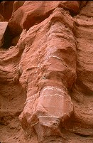
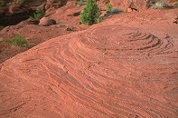
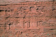
#img_8185
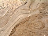
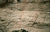
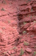
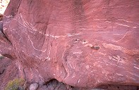
Varigated sandstone patterns. |
 |
#img_8184
Farther up the Uneva Mine canyon. Wingate sandstone on the walls, and Coconino sandstone making up the bulge of the Swell in the center. |
 |
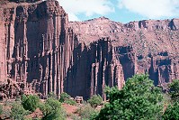
#img_8183
The Uneva Mine Canyon, second canyon south of I-70. Note the Navajo and Wingate formations, and in back, the Coconino sandstone, same formation that makes the Black Box. |
 |
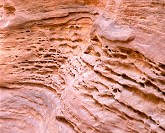
#img_8173
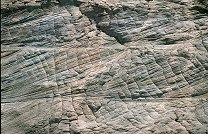
Swirls in the stone |
 |
#img_8100
Wingate sandstone Behind the Reef road San Rafael Swell |
 |
#img_8097
Navajo sandstone erosion Behind the Reef road San Rafael Swell |
 |
#img_8083
Navajo sandstone block Behind the Reef road San Rafael Swell |
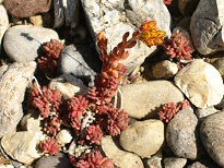 |
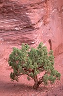
#img_5162
Stonecrop Sedum Cedar Mountain |
 |
#img_4960
Weathered Limestone |
 |
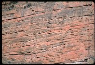
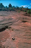
#127-2779
Cross-bedding on the sandstone, demonstrating the dune origin of this sand |
 |
#127-2754
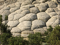
Checkered erosion, Navajo sandstone |
 |
#127-2745
Navaho sandstone domes along the Burr trail |
 |
#127-2709
One small section of the Navajo sandstone "teeth" on the Western edge of the Grand Gulch. Strike Valley Overlook Capitol Reef National Park |
 |
#127-2702
The Southern end of the grand gulch. These are the edges of upturned layers of rock, the upper layers have eroded long ago, leaving only a small ridge. I'm standing at the Strike Valley overlook, perched atop a 45 degree layer of Navajo sandstone. |
 |
#124-2410
Navaho sandstone Overlook, Utah Highway 12 |
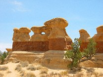 |
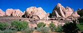
#123-2400
Goblins and Hoodoos (made of much harder sandstone than those in Goblin Valley or Bryce) Devils Garden Outstanding Nature Area 12 Miles off Utah Highway 12 next to the Hole-in-the-rock Road, Grand Staircase-Escalante Monument, |
 |
#117-1780_img
Sandstone walls, slot canyon Little Wild Horse Canyon Utah |
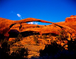 |
#230-1
Landscape Arch, sunrise Arches National Park Moab Utah |
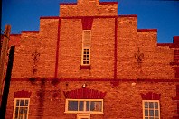 |
#202-19
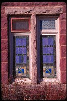
Old storefront, Pipestone MN. Pipestone MN |
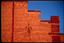 |
#202-22
Detail, storefront, Pipestone MN Pipestone MN |
 |
#203-20
Country road, moonrise. East of Pipestone MN |
 |
#203-25
Power Supstation, North of Pipestone MN |
 |
#2188
...Lady Micheline Elphinstone of the Shire of Falcon's Keep, called Meehesh, looking pensive and soaking up the reflection off all the Brass Hats, A Lost Boy whose name I don't know, and His Majesty King Fernando of Calontir. |
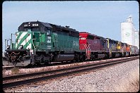 |
#2036
BN-SF locomotives loading grain south of Pipestone MN. |
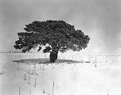 |
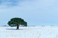
#lonetreeb
A lone evergreen in a cornfield, winter. W of Pipestone MN |
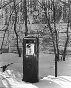 |
#pump
Old Conoco station, winter W of Pipestone MN |
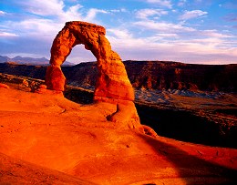 |
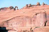
#225-1
Delicate Arch, sunset Arches National Park Moab Utah |
 |
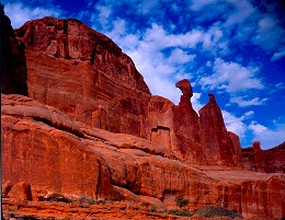
#226-3
Park Avenue Arches National Park Moab Utah |
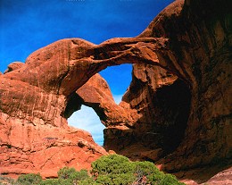 |
#222-4
Double Arch. Arches National Park Moab Utah |
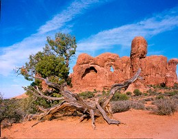 |
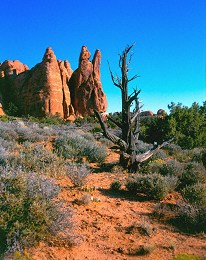
#222-2
Juniper and new arch. Trail to Double Arch, Arches N.P. Moab Utah |
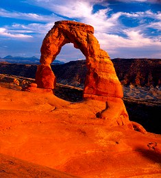 |
#226-4
Delicate Arch, sunset Arches National Park Moab Utah |
 |
#216-4
Old juniper and sandstone fin. Arches National Park Moab Utah |
 |
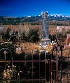
#200-28
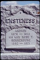
Miss Hilda Bergman, Aug. 27, 1886 to Jan. 20, 1903, porcelain photo on tombstone protestant cemetery, 8th Street Brookings SD |
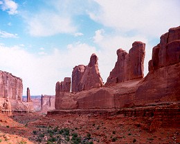 |
#229-1
Park Avenue Arches National Park Moab Utah |
 |
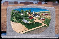
#276-02
Tombstone art, details. |
 |
#239-32
Echo Canyon, Utah |
 |
#1068
|
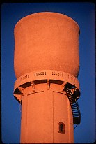 |
#202-27
The "Cup" water tower (telephone lines removed digitally) North side of town Pipestone MN |
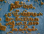 |
#207-30
The tombstone of Edwin Gunderson, age 11 months, beset by lichen. Prairie Queen Cemerery South of Volga SD |
 |
#2299
|
 |
#276-05
Tombstone art, details. |
 |
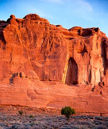
#219-1
Weathered sandstone, morning. Arches National Park Moab Utah |
 |
#a095-25
"Lone Tree in Winter"
W. of Pipestone MN |
 |
#276-01
Tombstone art, details. |
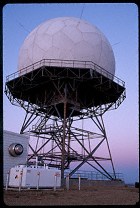 |
#098-31
FAA Radome South of Pipestone MN |
 |
#276-04
Tombstone art, details. |
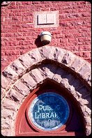 |
#249-31
Carnegie Library, Pipestone MN |
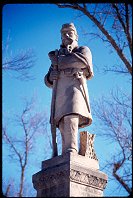 |
#249-34
Civil War Soldier monument, Pipestone MN |
 |
#250-05
|
 |
#250-24
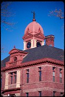
County Courthouse, Pipestone MN |
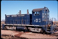 |
#250-36
Grain Elevator Switcher, North of Pipestone MN |
 |
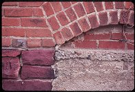
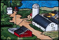
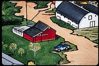
#252-10
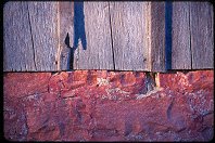
Wood and Stone, detail of barn, Dell Rapids SD |
 |
#251-04
Grain Elevators North of Pipestone MN |
 |
#275-37
Tombstone art. |
 |
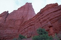
#312-4
Layers in the Navajo sandstone formation Arches National Park |
 |
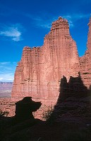
#2339
A shot of the sandstone layering and weathering seen in the Towers Fisher Towers |
 |
#2355
Weathered slickrock, and a stone cairn marking the towers trail |
 |
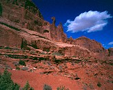
#2411
Two other hikers on the trail, giving a sence of the size of these sandstone formations. He is standing on a very small rise in comparison to the towers. Fisher Towers |
 |
#2312
Hiking trail below one of the sandstone towers. Fisher Towers BLM area, S-128, NE of Moab UT |
 |
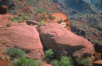
#2405
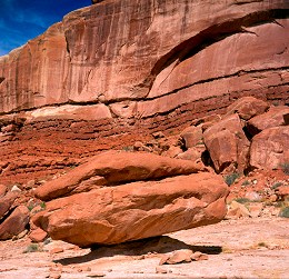
Medium shot of a wall, showing how the sandstone has over time 'melted' during rainstorms. This is not very solid sandstone. |
 |
#233-3
My great Uncle Ervin's gravestone. South park Cemetery Jackson WY |
 |
#2318
One of the Towers, sillouettes of sandstone formations, and the hiking trail barely visible at the base. |
 |
#310-1
Nefertitti's Head Park Avenue South Arches National Park Utah |
 |
#2384
Beautifully-weathered layered sandstone Fisher Towers BLM area |
 |
#320-1
Pocketted sandstone wall Little Wild Horse Canyon |
 |
#321-2
Pocketted sandstone wall Little Wild Horse Canyon |
 |
#332-4
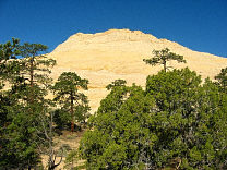
Navajo Sandstone domes, outside of Capitol Reef N.P. |
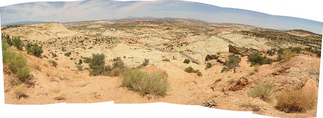 |
#122-3
Panorama, Navajo Sandstone Overlook, Utah Highway 12 South of Escalente Utah |
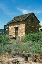 |
#352-13
An old stone house, off S-12 |
 |
#354-27
Checkerboarded Navajo sandstone |
 |
#355-27
Navaho sandstone, near Boulder Burr Trail |
 |
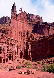
#305-3
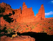
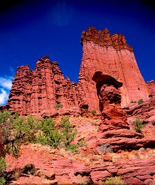
Fisher Towers, sunset Fisher Towers BLM area Moab Utah |
 |
#2406
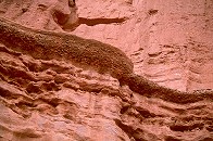
Layer of conglomerate in the sandstone Fisher Towers |
 |
#231-3
Park Avenue Arches National Park Moab Utah |
 |
#218-3
Old juniper and sandstone. Arches National Park Moab Utah |
 |
#217-4
Sandstone wall and juniper tree, sunrise Arches National Park Moab Utah |
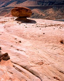 |
#224-3
Balanced rock on weathered Navajo sandstone Arches National Park (entrance road) Moab Utah |
 |
#231-4
Hoodoo and towers. Fishers Tower BLM site Off Utah S-128 |
 |
#223-1
Small balanced rock. Arches National Park (entrance road) Moab Utah |
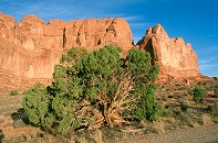 |
#2248
Juniper, sandstone wall Arches |
 |
#2311
The Towers hiking trail as it passes through one of the ravines between the towers. The metal ladder is visible. |
 |
#2228
Detail East side of Park Avenue. Arches N.P. |
 |
#2310
Juniper, the pink-orange sandstone of the towers Fisher Towers BLM area, off S-128 |
 |
#2341
Weathered wall Fisher Towers BLM area |
 |
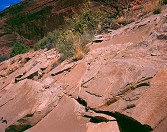
#2321
Weathered sandstone |
 |
#1024
|
 |
#2348
Weathered rock wall |
 |
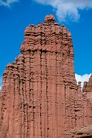
#2413
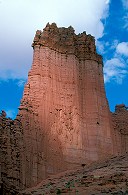
One of the magnificent towering sandstone fins Fisher Towers BLM area, off S-128, NE of Moab UT |
 |
#2319
Striated sandstone formations |
 |
#228-2
Towers Fishers Tower BLM site Off Utah S-128 |
 |
#2251
Delicate Arch, dimunitized by the massive sandstone wall below it. Arches N.P. |
Results from the Comments:
 |
JWLance
of Virginia
thought on 2/12/2005 that this photo was superb
and added the following: |
Results from the old catalog:
This search is a simple search for a word that appears somewhere in the database.
It is best to search a single word only. Multiple words are treated as OR.
If you find photos in the photographs section, you might want to look at
all the photographs in that photos directory to find similar matches.
Click here to list all keywords in the
database.
Click here to list the most popular photos in the
database.