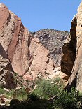
Sunset light in the clouds
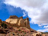
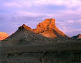
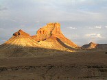
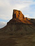
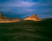
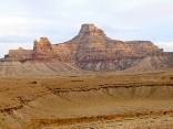
Ceder Mountain, San Rafael Swell

Query = 'swell'
Note that private photos will not be listed below unless you have logged in.
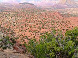
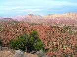
Results from the Directory listing:
| 2004/Nov08 | Large Format: Skyline Drive, San Rafael Swell | |
| 2004/Jun06 | San Rafael Swell and Joe's Valley (digital) | |
| 2004/May23 | San Rafael Swell: Moore road, and south of I-70 (digital) | |
| 2004/May11 | San Rafael Swell (digital) | |
| 2004/Mar15 | Strawberry Ridge in the Fall, San Rafael Swell, UVSC campus (LF) | |
| 2003/Oct25 | Fall colors on Strawberry Peak, West Reef of San Rafael Swell | |
| 2003/Jul02 | Cleaning out the LF film box: fall on Mt. Nebo, winter in Bryce Canyon, San Rafael Swell in winter and spring, Strawberry Peak in summer. | |
| 2003/May30 | Digital shots in the San Rafael Swell and vicinity. | |
| 2003/Apr26 | LF shots from Mt. Nebo (Fall), Bryce (Winter), and the San Rafael Swell (Winter & Spring). | |
| 2003/Mar31 | The San Rafael River valley, Mexican Mountain, San Rafael Swell. Digital. | |
| 2002/May11 | Digital shots: Cisco Utah, Goblin Valley State Park, San Rafael Swell, Bryce Canyon National Park, Capitol Reef National Park, Fisher Towers |
Results from the Photographs listing:
|
|
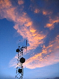
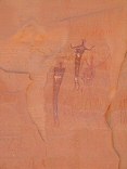
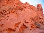
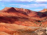
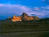
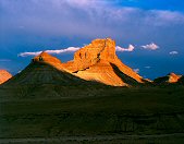
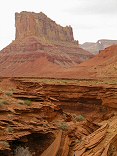
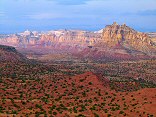
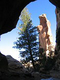
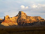
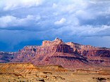
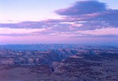
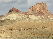
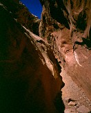
#img_0423
Sunset light in the clouds Ceder Mountain, San Rafael Swell |
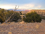 |
#img_0405
Cross near Sinkhole Flat San Rafael Swell |
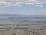 |
#img_9275
The northern Swell from Horn Mountain |
 |
#img_8409
As close as I could get to one of the long-tailed wild horses in the Swell McKay Flat |
 |
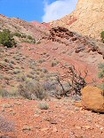
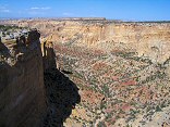
#img_8391
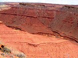
From the Behind the Reef Road, the red Moenkopi shleves, and beyond that the Kaibab limestone benches of the Swell interior |
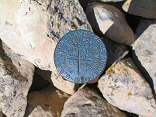 |
#img_8290
Survey marker, showing the intersection of four sections. These appear all over the swell. |
 |
#img_8275
The interior of the northen Swell form the north shoulder of Cow Canyon |
 |
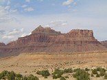
#483-4
Assembly hall peak, round peak, benches high wind San Rafael Swell |
 |
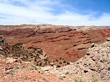
#img_8197
The bulk of the Swell that appears to be a point at Greasewood Canyon, as seen from the south of the Squeeze Note the size of the Reef (formed by the Grand Canyon Group) relative to the interior of the Swell, made of the Perminan Group), a difference of 1700 feet |
 |
#img_8184
Farther up the Uneva Mine canyon. Wingate sandstone on the walls, and Coconino sandstone making up the bulge of the Swell in the center. |
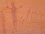 |
#img_8118
Panel detail Buckhorn Wash Pictograph panel San Rafael Swell |
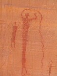 |
#img_8116
Panel detail Buckhorn Wash Pictograph panel San Rafael Swell |
 |
#img_8115
Panel detail Buckhorn Wash Pictograph panel San Rafael Swell |
 |
#img_8114
Buckhorn Wash pictograph panel detail Buckhorn Wash San Rafael Swell |
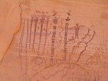 |
#img_8112
Buckhorn Wash pictograph panel detail Buckhorn Wash San Rafael Swell |
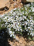 |
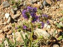
#img_8111
Phlox? Sulfur Springs road, Jackass Benches San Rafael Swell |
 |
#img_8101
The last climb down (or the first climb up going north) Behind the Reef road San Rafael Swell |
 |
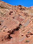
#img_8100
Wingate sandstone Behind the Reef road San Rafael Swell |
 |
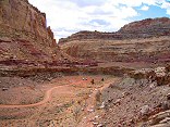
#img_8098
Behind the Reef Road ATV trail Behind the Reef road San Rafael Swell |
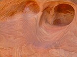 |
#img_8097
Navajo sandstone erosion Behind the Reef road San Rafael Swell |
 |
#img_8096
Cistern Canyon drainage (Moenkopi formation) Behind the Reef road San Rafael Swell |
 |
#img_8095
Cistern Canyon drainage (Moenkopi formation) Behind the Reef road San Rafael Swell |
 |
#img_8094
Cistern Canyon drainage (Moenkopi formation) Behind the Reef road San Rafael Swell |
 |
#img_8093
Cistern Canyon drainage (Moenkopi formation) Behind the Reef road San Rafael Swell |
 |
#img_8092
Slot Canyon swiss cheese, Cistern Canyon Behind the Reef road San Rafael Swell |
 |
#img_8091
One of the small problems one encounters on the ATV trail Cistern Canyon bottom, Behind the Reef road San Rafael Swell |
 |
#img_8089
Cistern Canyon enters the Reef Behind the Reef road San Rafael Swell |
 |
#img_8088
Cistern Canyon drainage (Moenkopi formation) Behind the Reef road San Rafael Swell |
 |
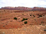
#img_8087
Behind the Reef road San Rafael Swell |
 |
#img_8086
Cistern Mine, South of Bell Canyon Behind the Reef road San Rafael Swell |
 |
#img_8083
Navajo sandstone block Behind the Reef road San Rafael Swell |
 |
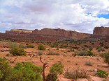
#img_8082
Behind the Reef road San Rafael Swell |
 |
#img_8081
Hondu Country Behind the Reef road San Rafael Swell |
 |
#img_8080
Chute Canyon exits the Reef Behind the Reef road San Rafael Swell |
 |
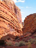
#img_8079
Inside the San Rafael Reef, at Crack and Chute Canyons Behind the Reef road San Rafael Swell |
 |
#img_8078
Inside the San Rafael Reef, at Crack and Chute Canyons Behind the Reef road San Rafael Swell |
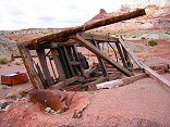 |
#img_8077
Toppled three-foot borehole rig Calyx Bench, Temple Mountian San Rafael Swell |
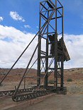 |
#img_8075
Three-foot borehole rig Calyx Bench, Temple Mountian San Rafael Swell |
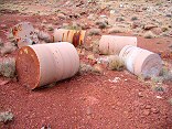 |
#img_8073
Three-foot core samples, flats east of Temple Mountian Calyx Bench, Temple Mountian San Rafael Swell |
 |
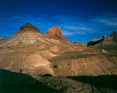
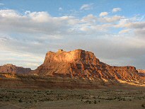
#img_8071
Temple Moutain, East side Temple Mountian San Rafael Swell |
 |
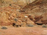
#img_8070
Vanadium King Mine office Temple Mountian San Rafael Swell |
 |
#482-2
Window Blind peak 1 inch rise Bridge, San Rafael Swell |
 |
#480-2
Assembly Hall peak 1 inch rise, clouds in the background Bridge, San Rafael Swell |
 |
#483-1
Assembly Hall peak, Windowblind peak 1 inch rise, clouds in the background Bridge, San Rafael Swell |
 |
#img_8061
Window Blind Peak West of the Bridge Campground San Rafael Swell |
 |
#481-4
Assembly Hall peak 1 inch rise, clouds in the background Bridge, San Rafael Swell |
 |
#480-1
Window Blind peak 1 inch rise Bridge, San Rafael Swell |
 |
#img_8058
Unnamed round peak and Assembly Hall Peak West of the Bridge Campground San Rafael Swell |
 |
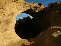
#img_8051
Hondu Arch Reds Canyon, Tomish Butte San Rafael Swell |
 |
#img_8047
Hondu Country: North Butte(?, just north of Tomish Butte) and Hondo Arch Reds Canyon San Rafael Swell |
 |
#img_8045
One of the main shafts, Lucky Strike Mine Reds Canyon San Rafael Swell |
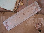 |
#img_8044
Worker pegboard, Lucky Strike Mine Reds Canyon San Rafael Swell |
 |
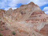
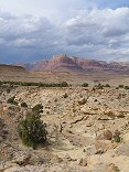
#img_8043
Scenic view down Reds Canyon Just north of Family Butte San Rafael Swell |
 |
#img_8041
Scenic view down Reds Canyon Just north of Family Butte San Rafael Swell |
 |
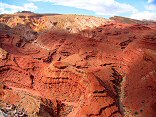
#img_8040
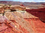
Layered Moenkopi formation Just north of Family Butte San Rafael Swell |
 |
#img_8039
Scenic view down Reds Canyon Just north of Family Butte San Rafael Swell |
 |
#img_8037
One steep part of the Devil's Racetrack. This was once the main road into the interior of the Swell. Devil's Racetrack San Rafael Swell |
 |
#img_8036
North end of the North Fork of Coal Wash Just below the Devil's Racetrack San Rafael Swell |
 |
#img_8033
Green Vein Mesa mine? North end of Reds Canyon San Rafael Swell |
 |
#img_8032
Green Vein Mesa mine? North end of Reds Canyon San Rafael Swell |
 |
#img_8031
Green Vein Mesa mine? North end of Reds Canyon San Rafael Swell |
 |
#img_8030
Unnamed pinnacle north of Family Butte North end of Reds Canyon San Rafael Swell |
 |
#img_8022
Broken Cross and Douglass Fir, as seen from the entrance of Honeymoon Cave Swaysey's Cabin, Head of Sinbad San Rafael Swell |
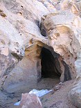 |
#img_8020
Honeymoon Cave Swaysey's Cabin, Head of Sinbad San Rafael Swell |
 |
#482-1
Assembly Hall peak 1 inch rise Bridge, San Rafael Swell |
 |
#img_7998
Unnamed round peak and Assembly Hall Peak West of the Bridge Campground San Rafael Swell |
 |
#img_7996
Window Blind Peak West of the Bridge Campground San Rafael Swell |
 |
#img_7995
Bottleneck Peak West of the Bridge Campground San Rafael Swell |
 |
#481-2
Assembly Hall peak Bridge, San Rafael Swell |
 |
#img_7978
Window Blind Peak West of the Bridge Campground San Rafael Swell |
 |
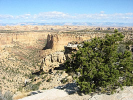
#img_7972
Cliffs above Mexican Mountain Road Lockhart Box San Rafael Swell |
 |
#img_7970
Lockhart Box San Rafael Swell |
 |
#img_7969
Lockhart Box San Rafael Swell |
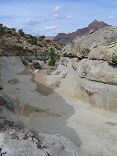 |
#img_7967
Small U-canyon wash Lockhart Box San Rafael Swell |
 |
#img_7966
Small U-canyon wash Lockhart Box San Rafael Swell |
 |
#img_7963
Small U-canyon wash Lockhart Box San Rafael Swell |
 |
#img_7961
Lomatium junecium Window Blind Peak San Rafael Swell |
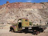 |
#img_7958
Truck, and Calf Mesa Mine in the background, upper left San Rafael Swell |
 |
#457-1
Cow & calf canyons, srswell Photo outcrop, Cedar mt, near brown bldg |
 |
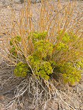
#img_4934
Phacelia. Grows very thick in some places in the Swell. Jackass Benches |
 |
#img_4860
Dutchman Arch Head of Sinbad, San Rafael Swell |
 |
#img_4584
Mexican Mountain Jackass Benches, San Rafael Swell |
 |
#img_4554
Assembly Hall Peak (right) The Bridge, San rafael Swell |
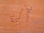
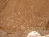 |
#img_4544
Cattle-Guard pictogrpahs Buckhorn Wash, San rafael Swell |
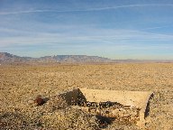 |
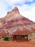
#img_4055
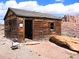
"Old building foundation"
Middle of nowhere, San Rafael Swell |
 |
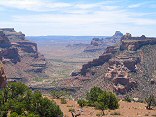
#118-1833_img
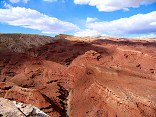
Inside the San Rafael Swell |
 |
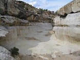
#311-1
Little Wild Horse slot canyon Near Goblin Valley State park, San Rafeal Swell Utah |
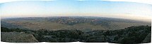 |
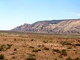
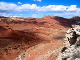
#sanrafaelnorth
Note the (slightly exagerated) bulge of the Swell |
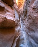 |
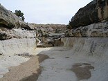
#311-2
Little Wild Horse slot canyon Near Goblin Valley State park, San Rafeal Swell Utah |
Results from the Comments:
No matches.Results from the old catalog:
This search is a simple search for a word that appears somewhere in the database.
It is best to search a single word only. Multiple words are treated as OR.
If you find photos in the photographs section, you might want to look at
all the photographs in that photos directory to find similar matches.
Click here to list all keywords in the
database.
Click here to list the most popular photos in the
database.