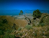
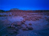
Old homested along the Upper Joe's Valley Road

Query = 'valley'
Note that private photos will not be listed below unless you have logged in.
Results from the Directory listing:
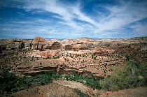
| 2004/Jun06 | San Rafael Swell and Joe's Valley (digital) | |
| 2003/Mar31 | The San Rafael River valley, Mexican Mountain, San Rafael Swell. Digital. | |
| 2002/May11 | Digital shots: Cisco Utah, Goblin Valley State Park, San Rafael Swell, Bryce Canyon National Park, Capitol Reef National Park, Fisher Towers | |
| 2001/Jun27 | Shots of Cascade Mountain, Utah Valley, parasailing, June UROC launch. |
Results from the Photographs listing:
|
|
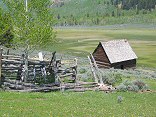
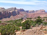
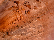
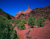
#img_9252
Old homested along the Upper Joe's Valley Road |
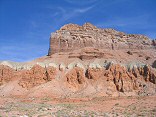 |
#img_8754
Wild Horse Butte, north of Goblin Valley |
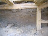 |
#img_8558
...but only about 6 feet deep with two drill holes. Rod's Valley Road |
 |
#img_8393
Moenkopi valley of Cistern Canyon |
 |
#img_8390
In the distance the Behind the Reef road climbs up the Kayenta shelf. Above is the Navajo, and below is the oddly-sloped Wingate. Below that is the Chinle/Moenkopi valley |
 |
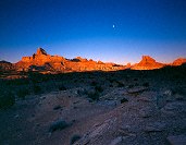
#458-1
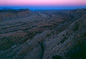
Window blind peak, bottleneck peak, assembly hall peak Turkey audible. Winter sun shines up valley/flats giving more even illumination and more dramatic angle. along mex mt rd, 1/4 mile further along |
 |
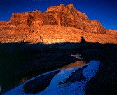
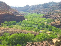
#img_4794
Morning view of the San rafael River valley East side of the Wedge |
 |
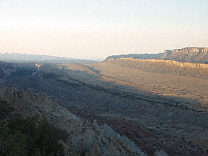
#445-4
San Rafael Valley, looking towards the Wedge Overlook some fwd tilt Mexican mountain rd |
 |
#447-2
San Rafael Valley, looking towards the Wedge Overlook some fwd tilt Mexican mountain rd |
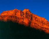 |
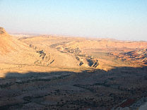
#444-3
Cliffs, San Rafael river valley near san rafael bridge |
 |
#445-2
Cliffs, San Rafael river valley near san rafael bridge |
 |
#403-4
Utah valley full extinguish (not much, really) Many big spiders in the tree. near peak of West mt |
 |
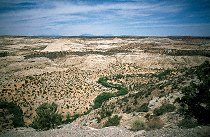
#127-2761
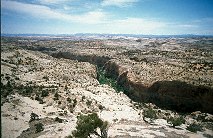
The Escalante River Valley |
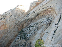 |
#127-2709
One small section of the Navajo sandstone "teeth" on the Western edge of the Grand Gulch. Strike Valley Overlook Capitol Reef National Park |
 |
#127-2704
Looking North, Strike Valley Overlook |
 |
#127-2702
The Southern end of the grand gulch. These are the edges of upturned layers of rock, the upper layers have eroded long ago, leaving only a small ridge. I'm standing at the Strike Valley overlook, perched atop a 45 degree layer of Navajo sandstone. |
 |
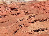
#126-2689
More swiss cheese erosion along the Strike Valley Overlook road |
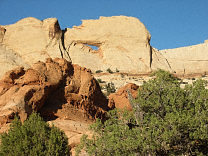 |
#126-2671
Peek-a-boo rock (?), on the Strike Valley Overlook 4WD road Capitol Reef National Park |
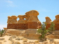 |
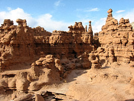
#123-2400
Goblins and Hoodoos (made of much harder sandstone than those in Goblin Valley or Bryce) Devils Garden Outstanding Nature Area 12 Miles off Utah Highway 12 next to the Hole-in-the-rock Road, Grand Staircase-Escalante Monument, |
 |
#118-1808_img
Two photographers, late afternoon Goblin Valley State Park |
 |
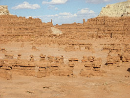
#117-1797_img
Behind the big green dome Goblin Valley State Park |
 |
#117-1793_img
Goblin Valley State Park |
 |
#117-1790_img
Goblin Valley State Park |
 |
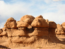
#117-1786_img
Hoodoos and goblins Goblin Valley State Park Utah |
 |
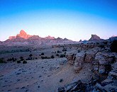
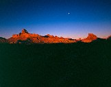
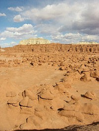
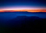
#324-1
Goblin Valley Twilight Goblin Valley State Park |
 |
#354-15
Escalante River valley |
 |
#354-19
Calf Creek valley |
 |
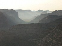
#357-2
The Waterpocket Fold, Grand Gulch, from the Strike Valley Overlook |
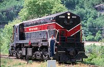 |
#a108-07
Heber Valley railroad (tourist) EMD engine. |
 |
#354-24
Boulder Creek Valley (Deer Creek in the background) |
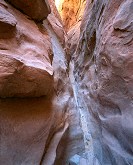 |
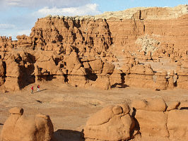
#311-2
Little Wild Horse slot canyon Near Goblin Valley State park, San Rafeal Swell Utah |
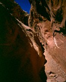 |
#311-1
Little Wild Horse slot canyon Near Goblin Valley State park, San Rafeal Swell Utah |
 |
#306-3
Receeding: Castle Tower, The Rectory, Nuns, and Priest Manti-La Sal Scenic Loop Professor Valley, off Utah 128 Utah |
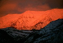 |
#272-15
Alpenglow on Cascade Peak, shot from the Valley, Sunset. Utah Valley Provo UT |
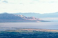 |
#v128-29
West Mountain, Utah lake, Provo Airport South Utah Valley, shot from Squaw Peak overlook, Orem Provo UT |
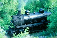 |
#v116-19
The "Heeber Creeper", Heber Valley RailRoad Engine No. 618, a coal-fired 2-8-4. Provo Canyon Utah |
Results from the Comments:
 |
Bruce Wilson
of Provo, Utah
thought on 2/23/2004 that this photo was displayed properly
and added the following: |
Results from the old catalog:
This search is a simple search for a word that appears somewhere in the database.
It is best to search a single word only. Multiple words are treated as OR.
If you find photos in the photographs section, you might want to look at
all the photographs in that photos directory to find similar matches.
Click here to list all keywords in the
database.
Click here to list the most popular photos in the
database.