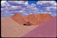
Query = 'rafael'
Note that private photos will not be listed below unless you have logged in.
Results from the Directory listing:
2004/Nov08 | Large Format: Skyline Drive, San Rafael Swell | |
2004/Jun06 | San Rafael Swell and Joe's Valley (digital) | |
2004/May23 | San Rafael Swell: Moore road, and south of I-70 (digital) | |
2004/May11 | San Rafael Swell (digital) | |
2004/Mar28 | San Rafael digital shots, including Behind the Reef road and Reds Canyon. | |
2004/Mar15 | Strawberry Ridge in the Fall, San Rafael Swell, UVSC campus (LF) | |
2003/Oct25 | Fall colors on Strawberry Peak, West Reef of San Rafael Swell | |
2003/Jul02 | Cleaning out the LF film box: fall on Mt. Nebo, winter in Bryce Canyon, San Rafael Swell in winter and spring, Strawberry Peak in summer. | |
2003/May30 | Digital shots in the San Rafael Swell and vicinity. | |
2003/Apr26 | LF shots from Mt. Nebo (Fall), Bryce (Winter), and the San Rafael Swell (Winter & Spring). | |
2003/Mar31 | The San Rafael River valley, Mexican Mountain, San Rafael Swell. Digital. | |
2002/May11 | Digital shots: Cisco Utah, Goblin Valley State Park, San Rafael Swell, Bryce Canyon National Park, Capitol Reef National Park, Fisher Towers |
Results from the Photographs listing:
#img_0423
Sunset light in the clouds Ceder Mountain, San Rafael Swell |
#img_0405
Cross near Sinkhole Flat San Rafael Swell |
#img_8803
San Rafael Knob, approaching storm |
#img_8587
Sunset, San Rafael Knob |
#img_8516
San Rafael Knob at the head of Reds Canyon |
#img_8352
San Rafael Knob and the head of Red Canyon |
#img_8345
Reds canyon, from the head near San Rafael Knob |
#img_8338
San Rafael Knob, center, in the distance |
#img_8319
To the left: San Rafael Knob |
#483-4
Assembly hall peak, round peak, benches high wind San Rafael Swell |
#img_8138
Sunset looking up the little grand canyon of the San Rafael River |
#img_8118
Panel detail Buckhorn Wash Pictograph panel San Rafael Swell |
#img_8116
Panel detail Buckhorn Wash Pictograph panel San Rafael Swell |
#img_8115
Panel detail Buckhorn Wash Pictograph panel San Rafael Swell |
#img_8114
Buckhorn Wash pictograph panel detail Buckhorn Wash San Rafael Swell |
#img_8112
Buckhorn Wash pictograph panel detail Buckhorn Wash San Rafael Swell |
#img_8111
Phlox? Sulfur Springs road, Jackass Benches San Rafael Swell |
#img_8101
The last climb down (or the first climb up going north) Behind the Reef road San Rafael Swell |
#img_8100
Wingate sandstone Behind the Reef road San Rafael Swell |
#img_8098
Behind the Reef Road ATV trail Behind the Reef road San Rafael Swell |
#img_8097
Navajo sandstone erosion Behind the Reef road San Rafael Swell |
#img_8096
Cistern Canyon drainage (Moenkopi formation) Behind the Reef road San Rafael Swell |
#img_8095
Cistern Canyon drainage (Moenkopi formation) Behind the Reef road San Rafael Swell |
#img_8094
Cistern Canyon drainage (Moenkopi formation) Behind the Reef road San Rafael Swell |
#img_8093
Cistern Canyon drainage (Moenkopi formation) Behind the Reef road San Rafael Swell |
#img_8092
Slot Canyon swiss cheese, Cistern Canyon Behind the Reef road San Rafael Swell |
#img_8091
One of the small problems one encounters on the ATV trail Cistern Canyon bottom, Behind the Reef road San Rafael Swell |
#img_8089
Cistern Canyon enters the Reef Behind the Reef road San Rafael Swell |
#img_8088
Cistern Canyon drainage (Moenkopi formation) Behind the Reef road San Rafael Swell |
#img_8087
Behind the Reef road San Rafael Swell |
#img_8086
Cistern Mine, South of Bell Canyon Behind the Reef road San Rafael Swell |
#img_8083
Navajo sandstone block Behind the Reef road San Rafael Swell |
#img_8082
Behind the Reef road San Rafael Swell |
#img_8081
Hondu Country Behind the Reef road San Rafael Swell |
#img_8080
Chute Canyon exits the Reef Behind the Reef road San Rafael Swell |
#img_8079
Inside the San Rafael Reef, at Crack and Chute Canyons Behind the Reef road San Rafael Swell |
#img_8078
Inside the San Rafael Reef, at Crack and Chute Canyons Behind the Reef road San Rafael Swell |
#img_8077
Toppled three-foot borehole rig Calyx Bench, Temple Mountian San Rafael Swell |
#img_8075
Three-foot borehole rig Calyx Bench, Temple Mountian San Rafael Swell |
#img_8073
Three-foot core samples, flats east of Temple Mountian Calyx Bench, Temple Mountian San Rafael Swell |
#img_8071
Temple Moutain, East side Temple Mountian San Rafael Swell |
#img_8070
Vanadium King Mine office Temple Mountian San Rafael Swell |
#482-2
Window Blind peak 1 inch rise Bridge, San Rafael Swell |
#480-2
Assembly Hall peak 1 inch rise, clouds in the background Bridge, San Rafael Swell |
#483-1
Assembly Hall peak, Windowblind peak 1 inch rise, clouds in the background Bridge, San Rafael Swell |
#img_8061
Window Blind Peak West of the Bridge Campground San Rafael Swell |
#481-4
Assembly Hall peak 1 inch rise, clouds in the background Bridge, San Rafael Swell |
#480-1
Window Blind peak 1 inch rise Bridge, San Rafael Swell |
#img_8058
Unnamed round peak and Assembly Hall Peak West of the Bridge Campground San Rafael Swell |
#img_8051
Hondu Arch Reds Canyon, Tomish Butte San Rafael Swell |
#img_8047
Hondu Country: North Butte(?, just north of Tomish Butte) and Hondo Arch Reds Canyon San Rafael Swell |
#img_8045
One of the main shafts, Lucky Strike Mine Reds Canyon San Rafael Swell |
#img_8044
Worker pegboard, Lucky Strike Mine Reds Canyon San Rafael Swell |
#img_8043
Scenic view down Reds Canyon Just north of Family Butte San Rafael Swell |
#img_8041
Scenic view down Reds Canyon Just north of Family Butte San Rafael Swell |
#img_8040
Layered Moenkopi formation Just north of Family Butte San Rafael Swell |
#img_8039
Scenic view down Reds Canyon Just north of Family Butte San Rafael Swell |
#img_8037
One steep part of the Devil's Racetrack. This was once the main road into the interior of the Swell. Devil's Racetrack San Rafael Swell |
#img_8036
North end of the North Fork of Coal Wash Just below the Devil's Racetrack San Rafael Swell |
#img_8033
Green Vein Mesa mine? North end of Reds Canyon San Rafael Swell |
#img_8032
Green Vein Mesa mine? North end of Reds Canyon San Rafael Swell |
#img_8031
Green Vein Mesa mine? North end of Reds Canyon San Rafael Swell |
#img_8030
Unnamed pinnacle north of Family Butte North end of Reds Canyon San Rafael Swell |
#img_8022
Broken Cross and Douglass Fir, as seen from the entrance of Honeymoon Cave Swaysey's Cabin, Head of Sinbad San Rafael Swell |
#img_8020
Honeymoon Cave Swaysey's Cabin, Head of Sinbad San Rafael Swell |
#482-1
Assembly Hall peak 1 inch rise Bridge, San Rafael Swell |
#img_7998
Unnamed round peak and Assembly Hall Peak West of the Bridge Campground San Rafael Swell |
#img_7996
Window Blind Peak West of the Bridge Campground San Rafael Swell |
#img_7995
Bottleneck Peak West of the Bridge Campground San Rafael Swell |
#481-2
Assembly Hall peak Bridge, San Rafael Swell |
#img_7978
Window Blind Peak West of the Bridge Campground San Rafael Swell |
#img_7972
Cliffs above Mexican Mountain Road Lockhart Box San Rafael Swell |
#img_7970
Lockhart Box San Rafael Swell |
#img_7969
Lockhart Box San Rafael Swell |
#img_7967
Small U-canyon wash Lockhart Box San Rafael Swell |
#img_7966
Small U-canyon wash Lockhart Box San Rafael Swell |
#img_7963
Small U-canyon wash Lockhart Box San Rafael Swell |
#img_7961
Lomatium junecium Window Blind Peak San Rafael Swell |
#img_7958
Truck, and Calf Mesa Mine in the background, upper left San Rafael Swell |
#img_7620
Lockhart Wash, near the San Rafael River |
#img_5124
Assembly Hall Peak, San Rafael River in foreground |
#img_4876
Assembly Hall Peak, San Rafael River in foreground |
#img_4860
Dutchman Arch Head of Sinbad, San Rafael Swell |
#463-1
San Rafael Reef West Jackass benches south of mex mt (above Swasey's leap turnoff) |
#463-2
San Rafael Reef West Jackass benches south of mex mt (above Swasey's leap turnoff) |
#img_4794
Morning view of the San rafael River valley East side of the Wedge |
#459-2
clearing storm, san rafael river exit canyon deep, rolling thunder from Book cliffs. I70 audible. South Jackass benches south of mex mt |
#img_4661
The canyons of th enorthern San Rafael. Window Blind Peak is prominent. |
#img_4584
Mexican Mountain Jackass Benches, San Rafael Swell |
#img_4554
Assembly Hall Peak (right) The Bridge, San rafael Swell |
#img_4544
Cattle-Guard pictogrpahs Buckhorn Wash, San rafael Swell |
#448-1
mexican mountain, san rafael reef (west side) second gate, mex. mt. rd., on cliff. |
#447-1
peaks, west sinbad, Pinnacle? south of assembly hall peak, san rafael |
#445-4
San Rafael Valley, looking towards the Wedge Overlook some fwd tilt Mexican mountain rd |
#447-2
San Rafael Valley, looking towards the Wedge Overlook some fwd tilt Mexican mountain rd |
#446-1
Assembly Hall Peak, San Rafael River in foreground metered 30, shot 45 sec Mexican Mountain rd |
#444-3
Cliffs, San Rafael river valley near san rafael bridge |
#445-2
Cliffs, San Rafael river valley near san rafael bridge |
#444-2
Cliffs, San Rafael river higher vantage near san rafael bridge |
#445-1
Cliffs, San Rafael river higher vantage near san rafael bridge |
#444-4
Cliffs, San Rafael river near san rafael bridge |
#img_4055
"Old building foundation"
Middle of nowhere, San Rafael Swell |
#118-1833_img
Inside the San Rafael Swell |
#118-1829_img
San Rafael Reef, neat I-70 |
#118-1828_img
San Rafael Reef, neat I-70 |
#sanrafaelnorth
Note the (slightly exagerated) bulge of the Swell |
Results from the Comments:
Jake Richens
of Salt Lake
thought on 6/23/2005 that this photo was superb
and added the following: |
Results from the old catalog:
This search is a simple search for a word that appears somewhere in the database.
It is best to search a single word only. Multiple words are treated as OR.
If you find photos in the photographs section, you might want to look at
all the photographs in that photos directory to find similar matches.
Click here to list all keywords in the
database.
Click here to list the most popular photos in the
database.