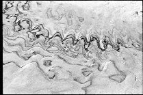
Rock crawling
Rocks south of Lake Mountain Elberta Utah

Query = 'south'
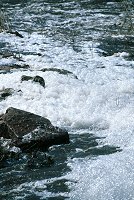
Note that private photos will not be listed below unless you have logged in.
Results from the Directory listing:
| 2005/July20 | A few shots at Panorama Point (Glen Canyon), and at the rock crawling area, south end of Lake Mountain. | |
| 2004/May23 | San Rafael Swell: Moore road, and south of I-70 (digital) | |
| 2001/Sep09 | Shots in and around the Union Pacific railyard in South Provo. | |
| 2001/May04 | Scenes of the flood in South Dakota, Spring 2001. | old |
Results from the Photographs listing:
|
|
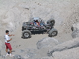
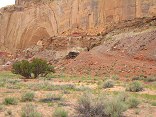
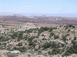
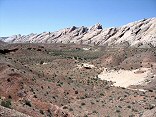
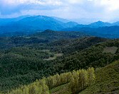
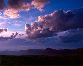
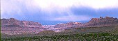
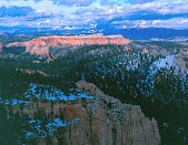
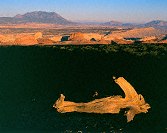
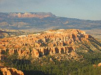
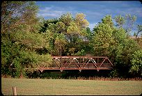
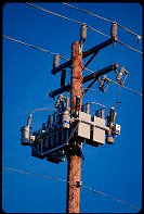
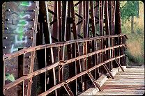
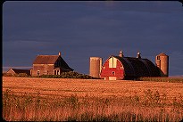
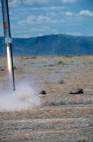
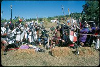
#img_0440
Rock crawling Rocks south of Lake Mountain Elberta Utah |
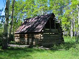 |
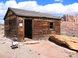
#img_9264
Barn along Indian Creek, south of the campground |
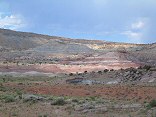 |
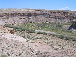
#img_9245
Morrison Formation south of Moore Road |
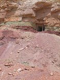 |
#img_8949
An adit at the top of the Chinle formation, south of Lucky Strike |
 |
#img_8938
Mine in a canyon south of the Lucky Strike |
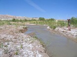 |
#img_8749
The ford across Muddy Creek. The Hunt's drove this road in from a mining road to the south. Vehicles cross from the lower left to the upper left by way of the kiosk. |
 |
#img_8650
The southern Reef from Big Wild Horse mesa, by the Huntsville Chevron #1 drill hole. |
 |
#img_8649
The Muddy Creek, southeast of the Wild Horse Creek wash |
 |
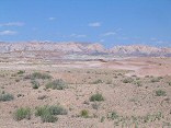
#img_8407
Looking across Sinbad Country to the southern Reef |
 |
#img_8367
Looking south down reds Canyon from the edge of Link Flats |
 |
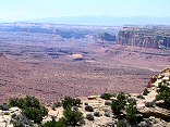
#img_8197
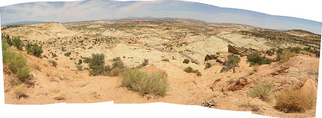
The bulk of the Swell that appears to be a point at Greasewood Canyon, as seen from the south of the Squeeze Note the size of the Reef (formed by the Grand Canyon Group) relative to the interior of the Swell, made of the Perminan Group), a difference of 1700 feet |
 |
#img_8183
The Uneva Mine Canyon, second canyon south of I-70. Note the Navajo and Wingate formations, and in back, the Coconino sandstone, same formation that makes the Black Box. |
 |
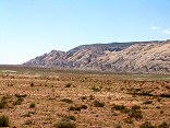
#img_8174
The Reef south of I-70. Note the increase of the pitch as the reef goes south. |
 |
#img_8086
Cistern Mine, South of Bell Canyon Behind the Reef road San Rafael Swell |
 |
#img_7709
Eva Conover Road, from South Coal Wash to I-70 |
 |
#img_6415
Along the Wardsworth Peak trail, South of Strawberry Peak |
 |
#467-1
looking south, powerhouse, spanish fork, nebo mtns Strawberry peak |
 |
#466-3
looking south Strawberry peak |
 |
#466-4
Mountains south of Strawberry peak Strawberry peak |
 |
#456-3
mexican mountain <i>full rise</i> West Jackass benches south of mex mt (above Swasey's leap turnoff) |
 |
#464-4
Cliffs along mexican mountain rd fule rise West Jackass benches south of mex mt (above Swasey's leap turnoff) |
 |
#463-1
San Rafael Reef West Jackass benches south of mex mt (above Swasey's leap turnoff) |
 |
#463-2
San Rafael Reef West Jackass benches south of mex mt (above Swasey's leap turnoff) |
 |
#464-3
Mexican mountain West Jackass benches south of mex mt (above Swasey's leap turnoff) |
 |
#459-2
clearing storm, san rafael river exit canyon deep, rolling thunder from Book cliffs. I70 audible. South Jackass benches south of mex mt |
 |
#462-4
Mexican mt & locale Jackass benches south of mex mt |
 |
#465-2
Mexican mt & locale Jackass benches south of mex mt |
 |
#447-1
peaks, west sinbad, Pinnacle? south of assembly hall peak, san rafael |
 |
#453-2
pink cliffs, south side of the Paria overlook, Powell Point illuminated Piracy point @ 7th turnout (big) =Farview point |
 |
#437-1
pink cliffs, south side of the Paria overlook Piracy point @ 7th turnout (big) =Farview point |
 |
#436-2
the eastern wall of the pink cliffs storm blowing in from south Rainbow point |
 |
#446-4
Peaks behind (southeast) of windowblind metered 60 sec, shot 90 window blind peak? mexican mt rd |
 |
#406-2
Organ, teeth, 35.5 f/stops Capitol reef? south end, by Muley twist |
 |
#406-1
white cliffs Southern Tarantula mesa, from border of Capitol reef and GS-E |
 |
#377-1
Hall 1 in rise Goshen, Center and 100 south Mona Utah |
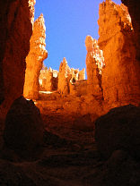 |
#129-2948
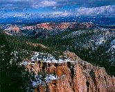
The Southern set of switchbacks Bryce Canyon National Park, Navajo Loop |
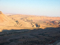 |
#127-2702
The Southern end of the grand gulch. These are the edges of upturned layers of rock, the upper layers have eroded long ago, leaving only a small ridge. I'm standing at the Strike Valley overlook, perched atop a 45 degree layer of Navajo sandstone. |
 |
#123-2356
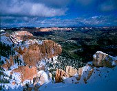
Bristlecone Point, with Powell Point (south end of the Aquarius Plateau) in the background Bryce Point Bryce Canyon National Park Utah |
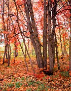 |
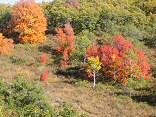
#183-1
A small grove of maple, low on the South side of the Alpine Loop. |
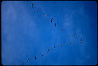 |
#272-20
Geese in formation flying South |
 |
#052-01
South of Brookings SD |
 |
#051-32
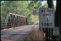
Bridge, South end of 22nd ave. Brookings SD |
 |
#051-23
Bridge, South end of 22nd ave. Brookings SD |
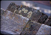 |
#051-22
Dry plank, lichen Bridge, South end of 22nd ave. Brookings SD |
 |
#052-31
South end of 22nd ave. Brookings SD |
 |
#051-08
Bridge, once a major road out of town South End of 22nd Avenue Brookings SD |
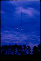 |
#053-23
Antennae, KJJQ Depot radio 910 AM South of Volga SD |
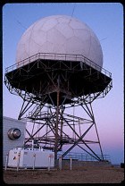 |
#098-31
FAA Radome South of Pipestone MN |
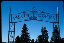 |
#208-02
The Prairie Queen Cemetery, names after an old church of the same name, now defunct. A few miles south of Volga SD |
 |
#1153
South Dakota: prettiest telephone poles in the world |
 |
#1297
South end of 22nd ave Brookings SD |
 |
#a100-03
Shots of the flooding conditions, Spring 2001, South Dakota. All the dead fish protein made for some very thick foam as it came over the dam |
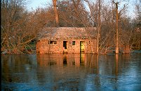 |
#a101-34
In the Spring of 2001 the Big Sioux river in Eastern South Dakota flodded. This is taken after the river started coming down, about a week after the rains stopped East side of town Egan South Dakota |
 |
#051-25
My favorite bridge Bridge, South end of 22nd ave. Brookings SD |
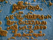 |
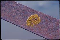
#207-30
The tombstone of Edwin Gunderson, age 11 months, beset by lichen. Prairie Queen Cemerery South of Volga SD |
 |
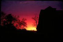
#a074-28
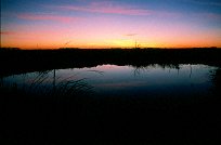
"Calm night, the Prairie"
A typical summer night on the prairie, with a typical South Dakota sunset. East of town, looking towards Brookings SD |
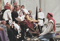 |
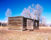
#n051-10
These are photographs taken at an SCA event, Armorgeddon, 14-17 Sept 2000, at Union County State Park south of Sioux Falls SD. |
 |
#062-08
The sun sets on another South Dakota farm US14 East of Brookings South Dakota |
 |
#1563
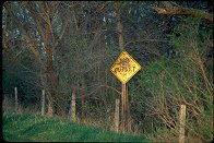
The sign that marks where a person died in a car accident. These are found all over South Dakota |
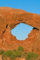 |
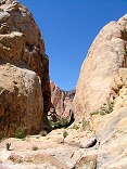
#2367
South Arch The Windows, Arches |
 |
#b040-01
FAA Radome South of Lake Benton MN |
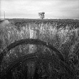 |
#b029-09
Barbed wire rolls South of Elkton SD |
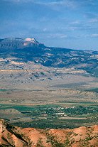 |
#349-12
In the distance, Powell Point, at the southern end of the Aquarius Plateau |
 |
#b083-01
"Grass and Ice"
A single stand of grass survives the prairie winter winds. The dark bands in the snow come from alternate deposits of snow and dust blown from the surrounding fields, then scoured down by the dry winds of winter South of town Elkton SD |
 |
#310-1
Nefertitti's Head Park Avenue South Arches National Park Utah |
 |
#297-2
"Paulo Bunyon's Woodpile" South of Eureka Utah |
 |
#277-4
Old ore processing plant, below Silver City, Utah, South of Eureka. |
 |
#233-3
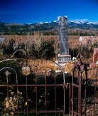
My great Uncle Ervin's gravestone. South park Cemetery Jackson WY |
 |
#122-3
Panorama, Navajo Sandstone Overlook, Utah Highway 12 South of Escalente Utah |
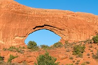 |
#2249
South arch The Windows, Arches N.P. |
 |
#062-30
Sky, clouds, and soybeans Just across the border from South Dakots into Minnesota |
 |
#145o-14
A big rocket surprises the photographer UROC members, http://www.UROC.org The UROC Pony Express Launch Site 15 miles South of Toole UT |
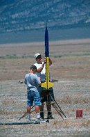 |
#l130-04
Preping a rocket for launch UROC Pony Express Launch Facility West Desert, about 15 miles South of Toole UT |
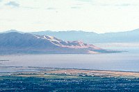 |
#v128-29
West Mountain, Utah lake, Provo Airport South Utah Valley, shot from Squaw Peak overlook, Orem Provo UT |
 |
#2041
This is my entry for 44º N 97º W. Looking South |
 |
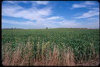
#2036
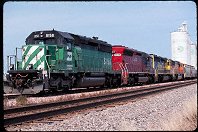
BN-SF locomotives loading grain south of Pipestone MN. |
 |
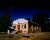
#083-04
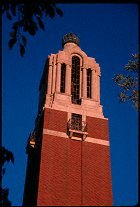
Bell Tower, South Dakota State University Campus |
 |
#v115-07
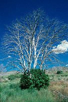
In 1999 there was a large fire South of Eureka, UT. All the trees were killed, and most have a clump of new growth around the base. |
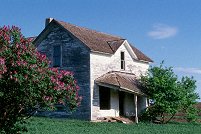 |
#a106-33
"Lilacs and Ruins"
An abandoned farm and equipment. I got there during Spring, just when the Lilacs were at their peak Western South Dakota |
 |
#2165
Company Nevermore on the left side of the frame, deploying from reserve to engage the south end of the bridge. |
 |
#233-1
This is the schoolhouse my grampa attended in his youth. It's located on the South Park Loop. It was subsequently used by my Uncle Nate as a workshop. The roof and floor are now gone, and only cows enjoy this view of it. South park Jackson WY |
Results from the Comments:
 |
Bruce Wilson
of Provo, Utah
thought on 5/31/2006 that this photo was displayed properly
and added the following: |
 |
Bruce Wilson
thought on 4/7/2001 that this photo was good
and added the following: |
Results from the old catalog:
This search is a simple search for a word that appears somewhere in the database.
It is best to search a single word only. Multiple words are treated as OR.
If you find photos in the photographs section, you might want to look at
all the photographs in that photos directory to find similar matches.
Click here to list all keywords in the
database.
Click here to list the most popular photos in the
database.